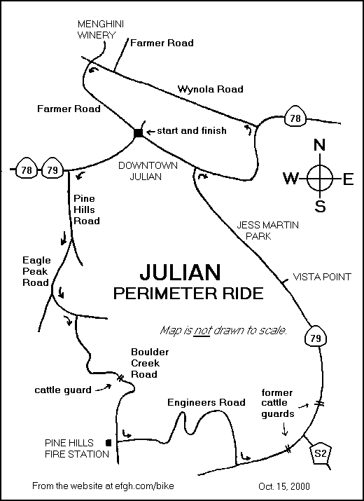
Julian Perimeter Ride
E-mail comments, corrections and additions to
pje@efgh.com.
A scenic and challenging ride around the mountain community of Julian,
California.
Julian has a high elevation and a temperate climate, and it usually snows a
few times each winter. Thunderstorms are fairly common. Check the weather
before you go. If there's no precipitation, this should be a good ride any
time of year.
Although the ride is only 26 miles long, the route is rather hilly. You should
allow at least three hours to complete the whole ride.
- 0.0 -- START at corner of Washington Street (Julian Road) and Main Street.
Proceed down Washington Street.
- 1.0 -- LEFT onto Pine Hills Road. For the next six miles, follow the signs
to PINE HILLS FIRE STATION.
- 2.6 -- RIGHT onto Eagle Peak Road.
- 4.0 -- LEFT onto Boulder Creek Road at fork in the road.
- 4.3 -- RIGHT onto Pine Hills Road. Prepare for a two-mile descent.
- 6.0 -- Cross a cattle guard while zipping downhill. Be careful!
- 6.5 -- Cross a bridge and start the notorious five-mile ascent.
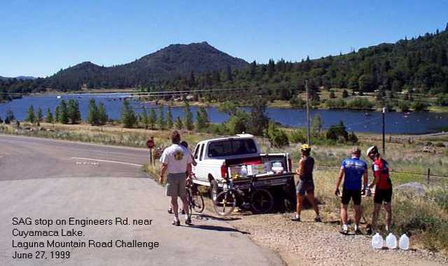
- 7.2 -- LEFT onto Engineers Road near the Pine Hills Fire Station.
- 10.7 -- Enter Cuyamaca Rancho State Park. This is a false summit. The worst
is yet to come!
- 11.4 -- The summit. It's not all downhill from here on, but there are no
more ascents like THAT one!
- Enjoy the view of Cuyamaca Lake.
- 12.9 -- LEFT at stop sign onto Highway 79.
- 13.6 -- Cross the site of another cattle guard (now paved over).
- 15.9 -- Cross the site of another cattle guard (now paved over).
- 18.4 -- Vista point off to the right, if you want to make a small side
trip.
- 20.9 -- RIGHT at stop sign onto Highway 78. If you want to cut your ride
short, the starting point is only about 1/4 mile to the left.
- 23.0 -- LEFT onto Wynola Road.
- 23.8 -- LEFT onto Farmer Road. (To the right, about 1/2 mile down
Julian Orchards Drive, is the Menghini Winery, another interesting
side trip.)
- 25.9 -- RETURN to starting point along Main Street.