
|
The Lusardi Creek LoopSan Diego, California
|
|
Please e-mail comments, corrections and additions to the webmaster at pje@efgh.com.
|
|
The Lusardi Creek LoopSan Diego, California
|
|
Please e-mail comments, corrections and additions to the webmaster at pje@efgh.com.
The Lusardi Creek Loop (LCL) is a series of hiking, equestrian and mountain biking trails around the Santa Luz district of San Diego, mostly through the Santa Luz Open Space Preserve. The Preserve is crossed or bounded by the Second San Diego Aqueduct, several power lines, and three arterial roads: Carmel Valley Rd., Camino Del Sur, and San Dieguito Rd.
Posted mile markers indicate that the LCL is 9.4 miles long, but my own survey measured only 7.79 miles. The LCL may have been rerouted in some places after the mile markers were installed. Mileages in the description below are according to my survey, and are slightly different from the mile markers. A second measurement on June 2, 2013 yielded 8.50 miles, but it followed an alternate route.
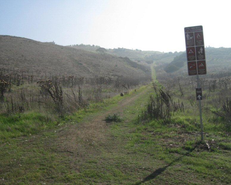
The LCL is signed, but most signs just say "trail", and signs are missing from some turns. Interpretive signs identifying local flora and other items of interest help to mark the LCL in some places. In some places, the LCL is called simply the Lusardi Loop, abbreviated "LL".
There is access to the LCL from city streets in several places, but only two signed trailheads -- Black Mountain Ranch Community Park and San Dieguito. LCL directions are posted at interpretive bulletin boards in some places. I photographed the directions and used a printed copy to follow the LCL. I found them slightly inadequate in several places, but I managed to follow the LCL anyway.
The posted directions assume a trip that begins and ends at the San Dieguito Trailhead, but the Black Mountain Ranch Park Trailhead has better facilities, and the posted mile markers measure the LCL from this point.
Trail Map (1457 X 1321, 323 KB)
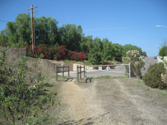
The trailhead is at the north end of Black Mountain Ranch Park, which is accessible from Carmel Valley Road (Thomas 1169 D7):
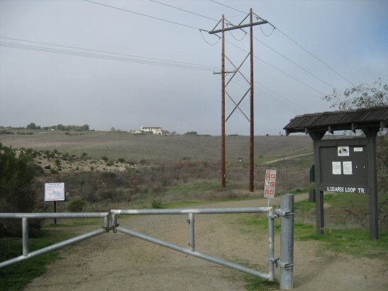
The Black Mountain Ranch Park Trailhead
N 32 59.382 W 117 7.824
Go around the gate and follow the dirt road 0.07 miles to an interpretive bulletin board in the middle of triangular trail junction, which is the beginning of the LCL:
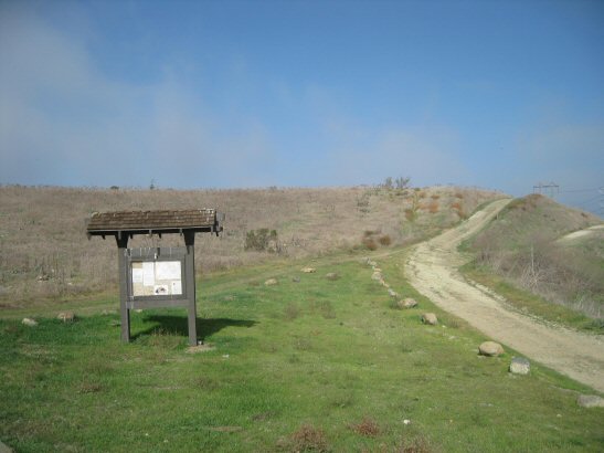
Beginning of LCL
N 32 59.448 W 117 7.924
Turn left and enter a single track. Follow it to mile 0.27, where it meets a dirt road, which is a service road for the Second San Diego Aqueduct. Turn left, go roughly 50 feet, and turn right into another single track:
LCL on Southwest Side of Aqueduct Access Road
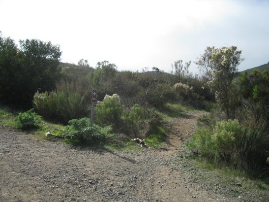
The LCL may be hard to follow in some places, because there are informal side trails. But when you pass interpretive plaques, you'll know you are on the LCL:
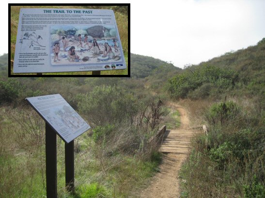
Interpretive Plaque on LCL
At roughly 0.50 miles (N 32 59.122 W 117 8.099) there is a fork in the trail. Follow the left (lower) fork.
At 0.73 miles, cross a bridge and turn left (the sign for this turn may be missing):
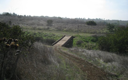
Turn Left After Crossing This Bridge
N 32 59.010 W 117 8.328
At 1.20 miles, the LCL jogs to the left and crosses a narrow paved road. Carmel Valley Rd. is on the other side of a gate to the left.
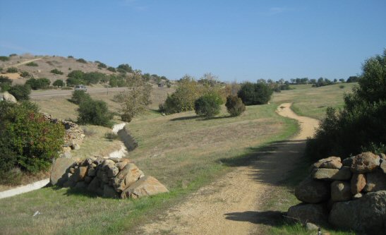
The LCL runs parallel to Carmel Valley Rd. almost touches it, and then plunges into a canyon:
LCL Plunges into a Canyon Near Carmel Valley Rd.
N 32 58.719 W 117 8.479
The LCL then follows a gravel road. At 1.76 miles, it turns right (the trail straight ahead apparently goes up to Camino Del Sur):
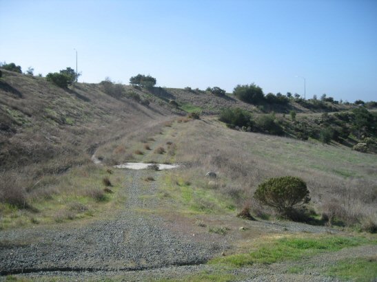
LCL Turns Right
N 32 58.794 W 117 8.913
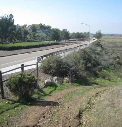
At 2.25 miles, the LCL emerges on a paved road called Lazanja Pass, where it turns left and runs right next to the road, passing under Camino Del Sur:
LCL Runs Next to Lazanja Pass
On the other side of Camino Del Sur, at 2.37 miles, the LCL turns left and follows Caminito Lazanja (to the right is a different trail):
LCL Turns Left at Caminito Lazanja
N 32 58.906 W 117 9.569
At 2.41 miles, the LCL turns right and descends into Lazanja Canyon on a narrow paved road:
LCL Turns Right and Descends into Lazanja Canyon
N 32 58.859 W 117 9.544
The pavement soon ends, and the LCL turns sharp and continues to descend into Lazanja Canyon.
At 2.71 miles, the LCL turns right and crosses Lazanja Creek on a wide causeway and continues uphill. At 2.85 miles it meets the south end of Camino De La Luna:
LCL Meets the South End of Camino De La Luna
N 32 58.929 W 117 9.922
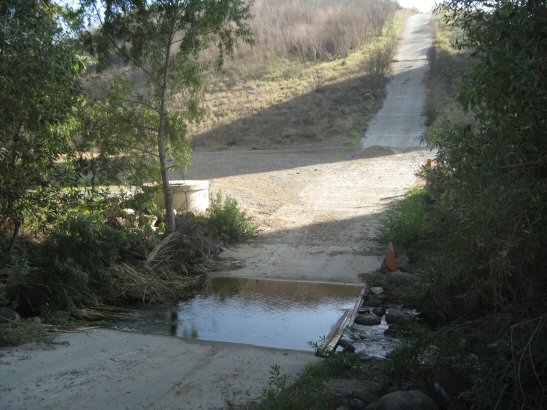
From here, the LCL runs along the left (west) side of Camino De La Luna. However, you may prefer to ride in the street, because the LCL fords a creek which sometimes floods (but it was dry on June 2, 2013):
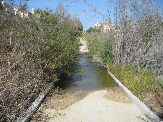
LCL Fords a Creek Next to Camino De La Luna
N 32 59.259 W 117 9.930
At 3.29 miles, where Camino De La Luna joins Camino De La Rosa, the LCL continues north between streets:
LCL on North Side of Camino De La Rosa
N 32 59.364 W 117 9.926
The path turns left and runs west next to another street (probably Encendido):
LCL Runs West Next to a Street
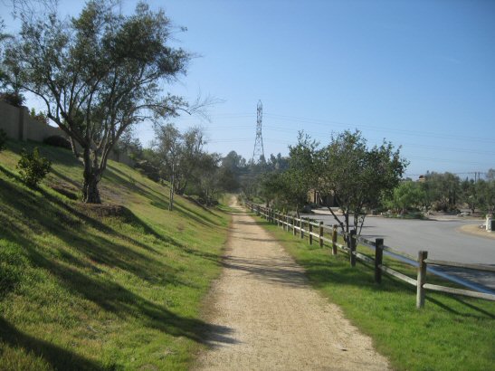
When the LCL reaches the power line tower visible in the preceding photograph at 3.66 miles, it turns north and runs near the power lines:
LCL Runs North Next to Power Lines
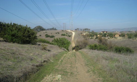
There are two fairly steep hills to climb because the power lines run in a straight line, ignoring topography. Just before reaching San Dieguito Rd., at 4.33 miles, the LCL turns right and runs roughly parallel to the road:
LCL Runs Roughly Parallel to San Dieguito Rd.
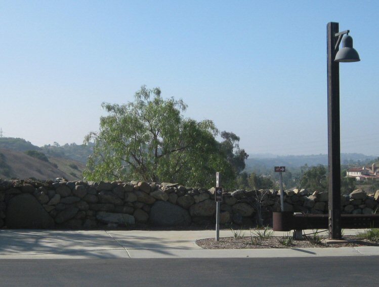
At 4.52 miles, cross over San Dieguito Rd. (watch for traffic!) and enter the San Dieguito Trailhead parking area:
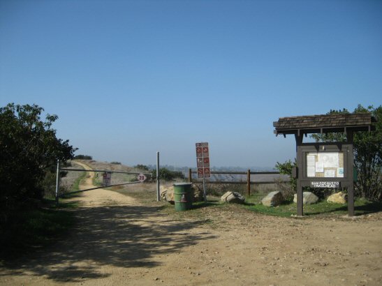
San Dieguito Trailhead
N 33 0.257 W 117 9.824
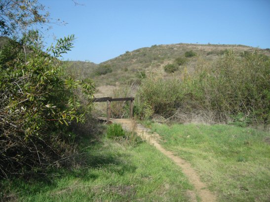
Go around the fence, and follow the LCL down into Lusardi Canyon. Where the trail turns right and descends into Lusardi Canyon (N 33 0.327 W 117 10.015), a small side trail leads to the Coast to Crest Trail.
At 5.93 miles the LCL turns left and crosses Lusardi Creek on a small bridge:
LCL Crosses Lusardi Creek
N 33 0.312 W 117 8.997
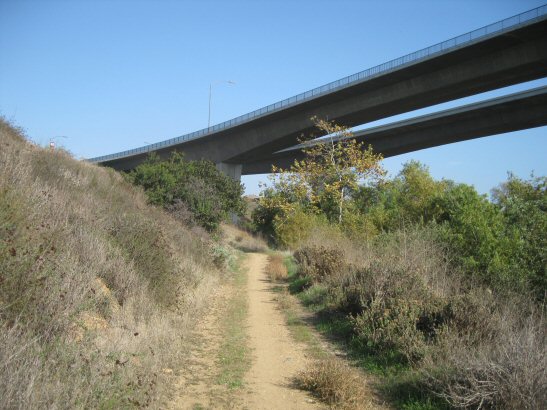
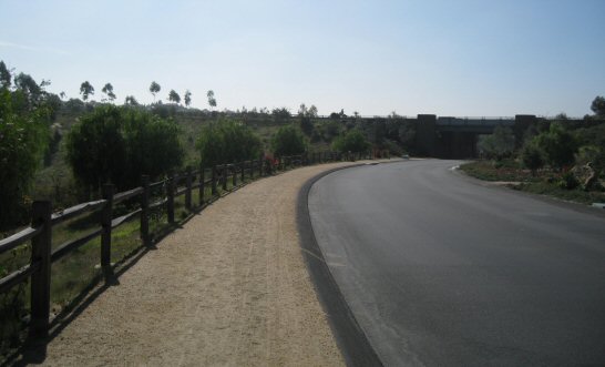
Continuing downstream on the other side of the creek, the LCL approaches the bridges carrying Camino Del Sur over the canyon:
Camino Del Sur Bridges over Lusardi Creek
The LCL turns right and crosses the creek right under the bridges:
LCL Crosses Lusardi Creek under Camino Del Sur
N 33 0.284 W 117 8.755
After crossing the creek, turn left and go up a small hill. Keep left at the next junction and then turn right at a four-way junction at 6.35 miles:
Turn Right at a Four-Way Junction
N 33 0.209 W 117 8.548
The road straight ahead is an alternate route, shown on some maps, which leads more or less directly to the triangular junction near Black Mountain Ranch Park, although it is not part of the official Lusardi Creek Loop.
At 7.29 miles, the LCL crosses a service road for some power lines. You can continue on the LCL, or you can follow the slightly steeper service road to the right. The LCL rejoins the road at 7.46 miles. Continue on the service road all the way back to the place where you entered the LCL. The total distance is 7.86 miles.
Go back to Black Mountain Ranch Park the way you came.