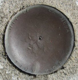
Name:        2969 K02
Identifier:
Lat/Lon:     N 32° 45.467 W 117° 2.243
Elevation:   458 FEET
Year:
Address:     7450 UNIVERSITY AVE, LA MESA CA 91941
Vicinity:    click here
Survey Date: 11/16/2014
Description: click here
Page 6 of 7 previous page | next page
|
| Name: 2969 K02 Identifier: Lat/Lon: N 32° 45.467 W 117° 2.243 Elevation: 458 FEET Year: Address: 7450 UNIVERSITY AVE, LA MESA CA 91941 Vicinity: click here Survey Date: 11/16/2014 Description: click here |
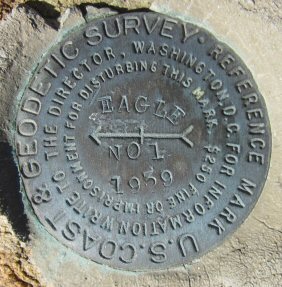
| Name: EAGLE NO 1 Identifier: DC1995 Lat/Lon: N 32° 59.052 W 116° 42.599 Elevation: 3214 FEET Year: 1939 Address: BOULDER CREEK RD & CEDAR CREEK RD, JULIAN CA 92036 Vicinity: click here Survey Date: 11/28/2014 Description: click here |
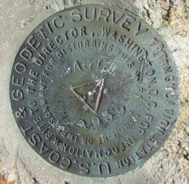
| Name: EAGLE Identifier: DC1995 Lat/Lon: N 32° 59.050 W 116° 42.600 Elevation: 3216 FEET Year: 1939 Address: BOULDER CREEK RD & CEDAR CREEK RD, JULIAN CA 92036 Vicinity: click here Survey Date: 11/28/2014 Description: click here |
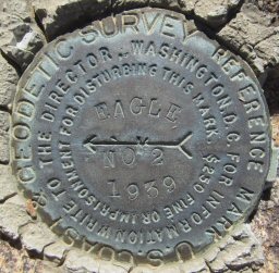
| Name: EAGLE NO 2 Identifier: DC1995 Lat/Lon: N 32° 59.048 W 116° 42.605 Elevation: 3215 FEET Year: 1939 Address: BOULDER CREEK RD & CEDAR CREEK RD, JULIAN CA 92036 Vicinity: click here Survey Date: 11/28/2014 Description: click here |
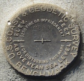
| Name: C580 Identifier: DX0357 Lat/Lon: N 33° 8.087 W 116° 22.010 Elevation: 1367 FEET Year: 1939 Address: HIGHWAY 78 AT STAG COVE, BORREGO SPRINGS CA 92004 Vicinity: click here Survey Date: 12/23/2014 Description: click here |
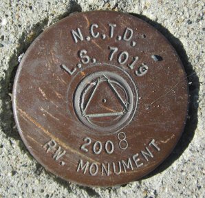
| Name: L.S. 7019 (2) Identifier: Lat/Lon: N 32° 59.946 W 117° 16.456 Elevation: 48 FEET Year: 2008 Address: 528 N HWY 101, SOLANA BEACH CA 92075 Vicinity: click here Survey Date: 1/1/2015 Description: click here |
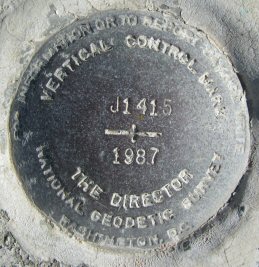
| Name: J1415 Identifier: DX3651 Lat/Lon: N 33° 0.096 W 117° 16.587 Elevation: 20 FEET Year: 1987 Address: 800 N HWY 101, SOLANA BEACH CA 92075 Vicinity: click here Survey Date: 1/1/2015 Description: click here |
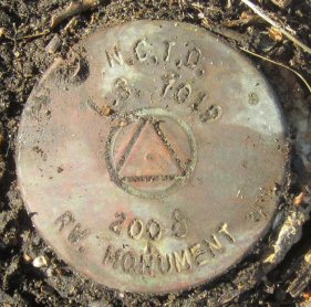
| Name: L.S. 7019 (3) Identifier: Lat/Lon: N 33° 3.365 W 117° 17.864 Elevation: 63 FEET Year: 2008 Address: 375 N COAST HWY 101, ENCINITAS CA 92024 Vicinity: click here Survey Date: 1/1/2015 Description: click here |
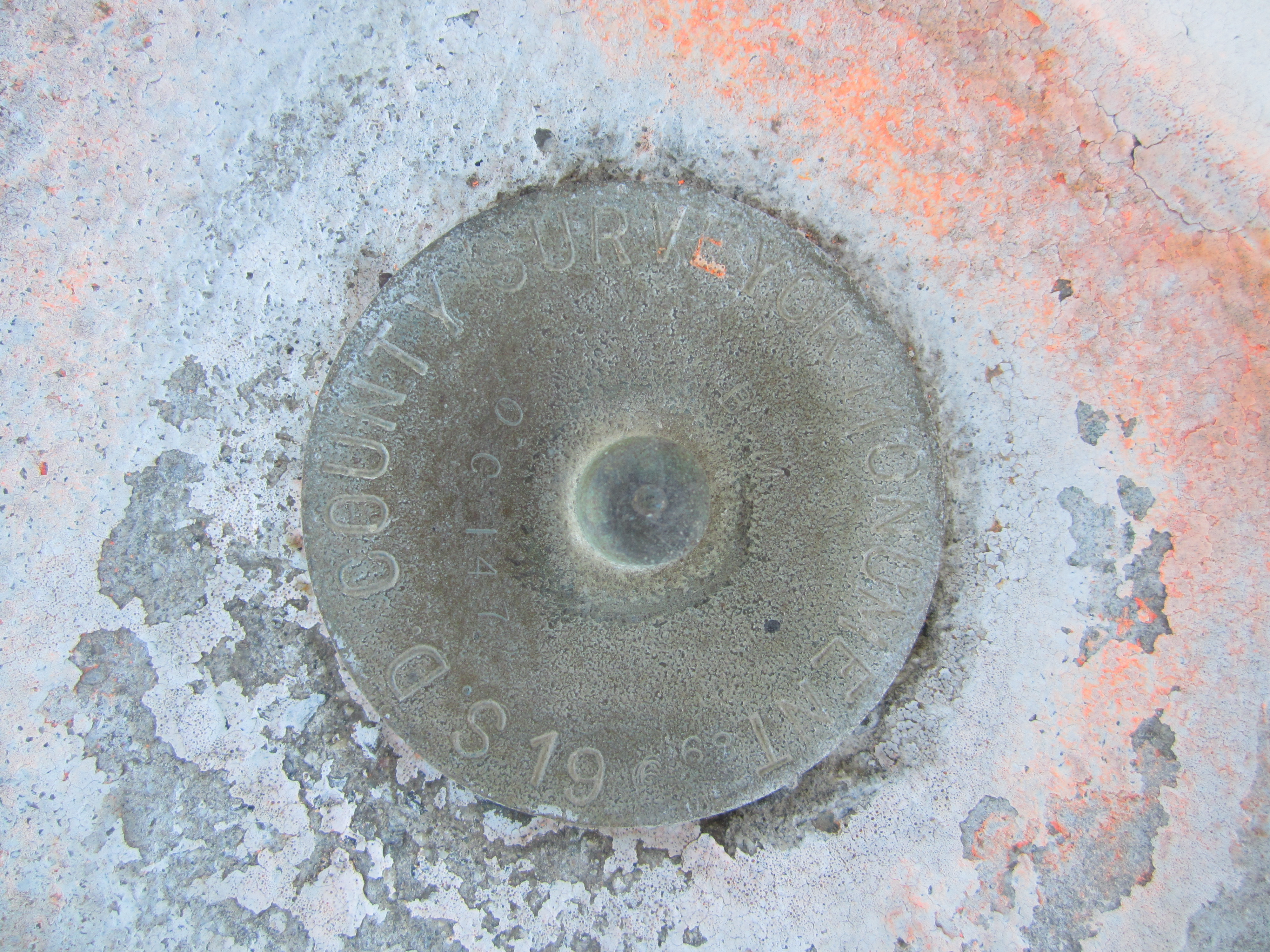
| Name: OC147 Identifier: DX1175 Lat/Lon: N 33° 5.625 W 117° 18.871 Elevation: 55 FEET Year: 1968 Address: 7380 CARLSBAD BLVD, CARLSBAD CA 92011 Vicinity: click here Survey Date: 1/1/2015 Description: click here |
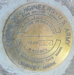
| Name: SEV101 Identifier: Lat/Lon: N 33° 0.983 W 117° 16.874 Elevation: 14 FEET Year: 1974 Address: 2188 S COAST HWY 101, CARDIFF CA 92007 Vicinity: click here Survey Date: 1/1/2015 Description: click here |
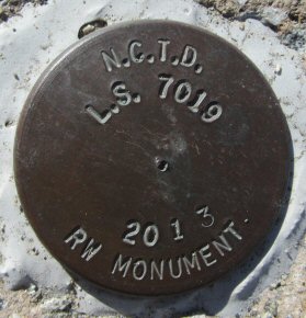
| Name: L.S. 7019 (1) Identifier: Lat/Lon: N 32° 58.902 W 117° 16.148 Elevation: 63 FEET Year: 2013 Address: 776 S HWY 101, SOLANA BEACH CA 92075 Vicinity: click here Survey Date: 1/1/2015 Description: click here |
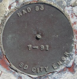
| Name: NAD 83 7-91 Identifier: Lat/Lon: N 32° 46.145 W 117° 12.543 Elevation: 24 FEET Year: 1991 Address: 1200 E MISSION BAY DR, SAN DIEGO CA 92110 Vicinity: click here Survey Date: 1/7/2015 Description: click here |
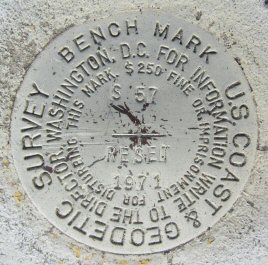
| Name: S57 RESET Identifier: DC1328 Lat/Lon: N 32° 38.174 W 117° 5.897 Elevation: 26 FEET Year: 1971 Address: 790 F ST, CHULA VISTA CA 91910 Vicinity: click here Survey Date: 1/13/2015 Description: click here |
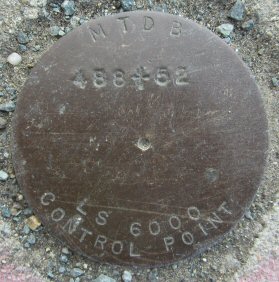
| Name: 488+52 Identifier: Lat/Lon: N 32° 36.925 W 117° 5.399 Elevation: 33 FEET Year: Address: 700 L ST, CHULA VISTA CA 91911 Vicinity: click here Survey Date: 1/13/2015 Description: click here |
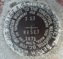
| Name: T57 RESET Identifier: Lat/Lon: N 32° 36.923 W 117° 5.456 Elevation: 53 FEET Year: 1971 Address: 715 L ST, CHULA VISTA CA 91911 Vicinity: click here Survey Date: 1/13/2015 Description: click here |
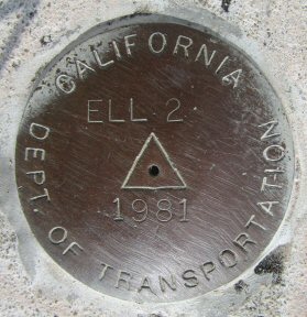
| Name: ELL 2 Identifier: Lat/Lon: N 32° 36.909 W 117° 5.504 Elevation: 58 FEET Year: 1981 Address: 785 L ST, CHULA VISTA CA 91911 Vicinity: click here Survey Date: 1/13/2015 Description: click here |
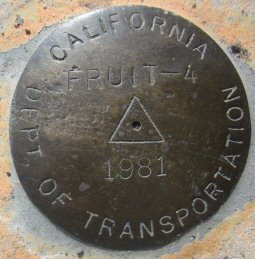
| Name: FRUIT-4 Identifier: Lat/Lon: N 32° 36.256 W 117° 5.373 Elevation: 64 FEET Year: 1981 Address: 826 PALOMAR ST, CHULA VISTA CA 91911 Vicinity: click here Survey Date: 1/13/2015 Description: click here |
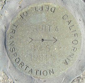
| Name: FRUIT 4 RM 5 Identifier: Lat/Lon: N 32° 36.265 W 117° 5.374 Elevation: 68 FEET Year: 1981 Address: 827 PALOMAR ST, CHULA VISTA CA 91911 Vicinity: click here Survey Date: 1/13/2015 Description: click here |
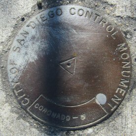
| Name: CORONADO-5 Identifier: Lat/Lon: N 32° 34.585 W 117° 4.905 Elevation: 75 FEET Year: Address: 2371 CORONADO AVE, SAN DIEGO CA 92154 Vicinity: click here Survey Date: 1/13/2015 Description: click here |
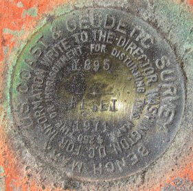
| Name: Y895 RESET Identifier: DC0687 Lat/Lon: N 32° 35.038 W 117° 5.220 Elevation: 59 FEET Year: 1971 Address: 2100 PALM AVE, SAN DIEGO CA 92154 Vicinity: click here Survey Date: 1/13/2015 Description: click here |
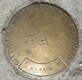
| Name: 5-PALM Identifier: Lat/Lon: N 32° 35.038 W 117° 5.271 Elevation: 60 FEET Year: Address: 2060 PALM AVE, SAN DIEGO CA 92154 Vicinity: click here Survey Date: 1/13/2015 Description: click here |

| Name: 805-PALM Identifier: Lat/Lon: N 32° 35.019 W 117° 2.268 Elevation: 262 FEET Year: 1992 Address: 4451 PALM AVE, SAN DIEGO CA 92154 Vicinity: click here Survey Date: 1/13/2015 Description: click here |
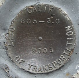
| Name: 805-3.0 Identifier: Lat/Lon: N 32° 35.035 W 117° 2.224 Elevation: 265 FEET Year: 2003 Address: 4480 PALM AVE, SAN DIEGO CA 92154 Vicinity: click here Survey Date: 1/13/2015 Description: click here |
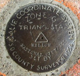
| Name: WILLOW Identifier: DC0730 Lat/Lon: N 32° 39.587 W 117° 2.602 Elevation: 77 FEET Year: 1954 Address: 3800 WILLOW ST, BONITA CA 91902 Vicinity: click here Survey Date: 1/13/2015 Description: click here |
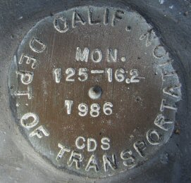
| Name: 125-16.2 Identifier: Lat/Lon: N 32° 45.562 W 117° 0.245 Elevation: 587 FEET Year: 1986 Address: 4400 MERRITT BLVD, LA MESA CA 91941 Vicinity: click here Survey Date: 1/27/2015 Description: click here |