|
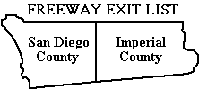
A list of freeway exits in San Diego and Imperial Counties and some
parts of Orange and Riverside Counties.
November 5, 2009 - Philip J. Erdelsky,
pje@efgh.com
|
- Introduction
- Interstate Highway 5 (San Diego Freeway)
- Interstate Highway 8 (Ocean Beach, Alvarado and Kumeyaay Freeways)
- California Highway 15 and Interstate Highway 15 (Escondido Freeway)
- Interstate Highway 805 (Jacob Dekema Freeway)
- California Highway 163 (Cabrillo Freeway)
- California Highway 94 (Martin Luther King Jr. Freeway)
- California Highway 125 (Helix Freeway, South Bay Expressway)
- California Highway 78
- California Highway 52 (San Clemente Canyon Freeway)
- California Highway 54 (South Bay Freeway)
- California Highway 56 (Ted Williams Parkway)
- California Highway 67 (San Vicente Freeway)
- California Highway 905
- Kearny Villa Road
- Epilogue
Return to home page.
EXIT SIGNS
Nearly every freeway exit in Southern California is
marked by a sign with white lettering on a green background. Each entry
in this document shows, as nearly as possible, the wording on the exit
sign, and the approximate distance in miles from the beginning of the
listed part of the freeway to the exit. This information should be
useful in estimating travel distances and giving precise directions,
since a few freeway exits in Southern California are not yet numbered.
Freeway exits in California were numbered during the three-year period
from 2002 to 2004. The exit number is the approximate number of miles
from the south or west end of the freeway. Exits less than one mile
apart are distinguished by letters after the exit numbers. Numbers have
already been assigned or proposed for all exits, and are shown on this
list as comments. Most numbers have already been posted, but they are
not necessarily on the exit signs. They may be on other signs near the
exits. In many cases, a sign that formerly said merely "EXIT" or "RAMP"
has been replaced by one that contains the word "EXIT", the exit number
and an arrow.
Freeway exit numbers may not be precisely consistent with the
mileages given in this list because eastbound and westbound exits to
the same highway are given the same number, even though they may be
more than a mile apart. Also, my odometer may not agree precisely
with Caltrans's odometer.


When an exit number is added to an exit sign, the wording of the
sign is sometimes changed slightly. Such changes will be reflected
in this list as soon as possible.
For the latest
information on California freeway exit numbers, check the Caltrans
Web page at
www.dot.ca.gov/hq/traffops/signtech/calnexus/index.htm. These
pages are updated occasionally to show which exit numbers have been posted.
The 2003 and later Thomas Guides show freeway exit numbers on the detail maps.
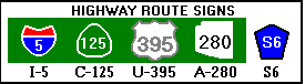
SYMBOLS USED ON EXIT SIGNS
A few symbols are used on exit signs. Since this document consists
almost entirely of text, abbreviations are used to represent some of
these symbols:
-
A California state highway is represented by enclosing the route
number in a triangle with rounded sides. In this document, the
prefix "C-" is used for this purpose. Hence C-125 represents the
number 125 enclosed in such a triangle.
-
An interstate highway is represented by enclosing the route number
in a shield with a blue background. At the top of the shield is the
word "INTERSTATE" in white letters on a red background. In this
document, the prefix "I-" is used for this purpose. Hence I-5
represents the number 5 enclosed in such a shield.
-
A federal highway is represented by enclosing the route number
in a black-and-white shield of a different shape. In this
document, the prefix "U-" is used for this purpose. Hence U-395
represents the number 395 enclosed in such a shield.
-
An Arizona state highway is represented by enclosing the route
number in an outline of Arizona. In this document, the prefix
"A-" is used for this purpose. Hence A-280 represents the number
280 enclosed in such an outline.
Commas are used in this document to divide exit sign text into logical
groups. The commas themselves do not appear on exit signs.
In fact, exit signs usually do not contain punctuation of any kind.
Here are pictures of some typical route markers:
OTHER MATERIAL ASSOCIATED WITH EXITS
Explanatory material that does not appear on exit signs is enclosed in
parentheses. For example, in the few cases where an exit is on the left
side, that fact is noted. Freeway exit numbers, where
available, are enclosed in parentheses.
San Diego, Imperial and Orange County route numbers,
consisting of the letter "S" and a number, do not appear on exit
signs. However, interchanges with county highways are often marked by
auxiliary signs some distance ahead of the exits themselves. In this
list, such interchanges are noted in explanatory material.
Riverside County route numbers consist of the letter "R" and a number.
Some extraneous words that do appear on exit signs, such as
"Exit Only", have been omitted from this list.
Bicycles are permitted on the freeway shoulder
wherever the following symbol appears:

FREEWAY NAMES
Most freeways in Southern California are now identified by number, not
by name. However, freeway names have been noted in the section headings.
In recent years, small signs have been posted on some freeways marking
them as memorials to individuals. Where available, these names are mentioned in the
introductory text for each freeway.
CALL BOXES
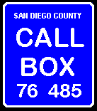 |
There are now emergency call boxes on freeways in San Diego, Imperial,
Orange, and Riverside Counties. Each one is marked
by a rectangular sign with the words "Call Box" in white lettering on a
blue background. At the bottom of the sign are two numbers. The first is
the highway number, and the second is the approximate distance, in
tenths of a mile, from the southern or western end of the highway (or
the place where it enters the county). In the case of
highways under construction, the distance is apparently measured from what
will be the end of the highway when it is finished.
|
In San Diego County, call boxes on the south and east sides of
freeways bear even numbers and call boxes on the north and west sides bear
odd numbers. (This convention is the opposite of that used for building
numbers in much of the San Diego area.) The convention in other counties
may be different.
There are also call boxes on state highways that are not freeways,
on a few roads that are not state highways or freeways,
and in a few other places. Call boxes were
put on I-8 in Imperial County in early 2000; before that time there were no
call boxes in Imperial County.
Many call boxes have keyboards for use by motorists with
speech or hearing impairments.
This list is a truncated version of a
larger list that included
additional exits in Orange and Riverside Counties and in Arizona.
The list was becoming out-of-date; therefore I cut it down to
a manageable size. The original is still available, but it will
no longer be updated.
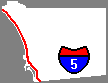
The part of I-5 south of Downtown San Diego is sometimes called the
Montgomery Freeway.
I-5 runs parallel to old US Highway 101 and has entirely replaced it
within San Diego County.
Carlsbad Village Dr. was formerly called Elm Ave. The old name is still
used by some Carlsbad residents and appears on exit signs in tiny letters.
Coast Hwy. in Oceanside was formerly called Hill Street. The old
name still appears on some exit signs in tiny letters.
The part of I-5 running through Camp Pendleton is signed as the
"Gunnery Sergeant John Basilone Freeway".
I-5 has been widened and improved between the junction with I-805
and the Del Mar Heights Road interchange. The work, which was
completed in April 2007, includes local bypass lanes and
a new interchange with Carmel Mountain Road, which is accessible
only from the local bypass lanes.
I-5 Northbound
- 000.0 - (freeway begins at US-Mexico border)
- 000.3 - (exit 1A) NORTH I-805 (also San Ysidro Blvd)
- 000.8 - (exit 1B) Via de San Ysidro
- 002.0 - (exit 2) San Ysidro Blvd, Dairy Mart Rd
- 002.6 - (exit 3) C-905 EAST, Tocayo Ave
- 003.7 - (exit 4) Coronado Ave
- 004.4 - (exit 5A) Palm Avenue, C-75
- 005.3 - (exit 5B) Main Street
- 005.8 - (exit 6) Palomar St
- 006.5 - (exit 7A) L Street
- 007.1 - (exit 7B) J Street, Marina Pkwy
- 007.7 - (exit 8A) H Street
- 008.5 - (exit 8B) E Street
- 009.0 - (exit 9) C-54 EAST
- 010.1 - (exit 10) Mile of Cars Way, Bay Marina Dr (formerly 24th Street)
- 010.6 - (exit 11A) Harbor Dr, Civic Center Dr
- 010.9 - (exit 11B) Plaza Blvd, Downtown (Downtown National City)
- 011.9 - (exit 12) Main St, Division St
- 012.5 - (exit 13A) NORTH C-15, Riverside
- 013.4 - (exit 13B) 28th Street, National Ave
- 014.1 - (exit 14A) C-75, Coronado
- 014.3 - (exit 14B) Cesar E Chavez Parkway (formerly Crosby Street)
- 014.9 - (exit 15A) C-94 EAST, J Street, M L King Jr Fwy
- 015.2 - (exit 15B) Pershing Dr, Civic Center (also B Street)
- 016.2 - (exit 16A) NORTH C-163, Escondido
- 016.5 - (exit 16B) 6th Avenue, Downtown (Downtown San Diego)
- 017.0 - (exit 17A) Hawthorn Street, San Diego Airport
- 017.7 - (exit 17B) Sassafras St (also India Street)
- 017.9 - (exit 18A) Pacific Hwy
- 018.3 - (exit 18B) Washington Street
- 019.3 - (exit 19) Old Town Avenue
- 020.2 - (exit 20) I-8 WEST Beaches, I-8 EAST El Centro
- 021.2 - (exit 21) Sea World Drive, Tecolote Road
- 022.6 - (exit 22) Clairemont Drive, Mission Bay Drive
- 023.3 - (exit 23A) Grand Avenue, Garnet Avenue
- 023.9 - (exit 23B) EAST Balboa Avenue (Balboa Ave formerly also C-274)
- 026.3 - (exit 26A) WEST La Jolla Pkwy (formerly Ardath Rd)
- 026.4 - (exit 26B) C-52 EAST
- 027.3 - (exit 27) Gilman Drive, La Jolla Colony Dr (also UCSD)
- 028.7 - (exit 28A) Nobel Dr
- 029.0 - (exit 28B) La Jolla Village Dr
- 030.1 - (exit 29) Genesee Ave
- 030.9 - (exit 30) Sorrento Valley Rd
- 031.3 - LOCAL BYPASS, Jct C-56 EAST (also Carmel Mountain Rd)
- 032.7 - (exit 32) Carmel Mountain Rd (accessible only from LOCAL BYPASS)
- 033.6 - (exit 33A) C-56 EAST (accessible only from LOCAL BYPASS)
- 033.7 - (exit 33B) Carmel Valley Rd
- 034.9 - (exit 34) Del Mar Heights Road
- 037.1 - (exit 36) Via De La Valle (also S6)
- 038.3 - (exit 37) Lomas Santa Fe Dr (also S8)
- 039.7 - (exit 39) Manchester Ave
- 040.8 - (exit 40) Birmingham Dr
- 041.6 - (exit 41A) Santa Fe Dr, Encinitas
- 042.6 - (exit 41B) Encinitas Blvd (also S9)
- 043.8 - (exit 43) Leucadia Blvd
- 045.3 - (exit 44) La Costa Ave
- 046.8 - (exit 45) Poinsettia Lane, Aviara Pkwy
- 048.3 - (exit 47) Palomar Airport Road (also Carlsbad Blvd, S12)
- 049.3 - (exit 48) Cannon Rd (also Legoland)
- 050.6 - (exit 49) Tamarack Avenue
- 051.5 - (exit 50) Carlsbad Village Dr (formerly Elm Ave)
- 052.1 - (exit 51A) Las Flores Dr
- 052.6 - (exit 51B) C-78 EAST, Escondido (also Vista)
- 052.9 - (exit 51C) Vista Way
- 054.0 - (exit 52) Oceanside Blvd
- 054.6 - (exit 53) Mission Ave, Downtown (Downtown Oceanside)
- 055.3 - (exit 54A) C-76 EAST, Coast Hwy (Coast Hwy formerly Hill St)
- 056.0 - (exit 54B) Camp Pendleton (also Capistrano Drive)
- 056.2 - (exit 54C) Oceanside Harbor Dr
- 061.1 - (exit 59) REST AREA (Aliso Creek)
- 064.0 - (exit 62) Las Pulgas Road
- 069.0 - (exit 67) WEIGH STATION
- 069.4 - (Border Patrol Checkpoint)
- 073.6 - (exit 71) Basilone Rd, San Onofre
- 074.5 - (exit 72) Cristianitos Road
- 075.9 - (exit 73) Ave Magdelena
- 076.3 - (exit 74) El Camino Real
- 077.0 - (exit 75) Ave Presidio, San Clemente
- 078.1 - (exit 76) Ave Pico
- 078.6 - (exit 77) Ave Vista Hermosa
- 080.6 - (exit 78) Camino de Estrella
- 081.3 - (exit 79) C-1, Beach Cities, Camino Las Ramblas
- 083.5 - (exit 81) Camino Capistrano (also San Juan Creek Rd, Valle Rd)
- 084.6 - (exit 82) Ortega Hwy, C-74, San Juan Capistrano
- 085.9 - (exit 83) Junipero Serra Rd
- 086.2 - (exit 85A) C-73 NORTH TOLL ROAD, Long Beach
- 088.1 - (exit 85B) Avery Parkway
- 088.8 - (exit 86) Crown Valley Pkwy
- 090.3 - (exit 87) Oso Pkwy
- 091.8 - (exit 89) La Paz Rd
- 092.7 - (exit 90) Alicia Pkwy
- 093.9 - (exit 91) El Toro Road (also S18, Laguna Hills, Lake Forest)
I-5 Southbound
- 000.0 - (exit 91) El Toro Rd (also S-18, O'Neill Park)
- 001.2 - (exit 90) Alicia Pkwy
- 002.2 - (exit 89) La Paz Rd (also Laguna Niguel Park)
- 003.5 - (exit 88) Oso Parkway (also Riley Wilderness Park)
- 005.1 - (exit 86) Crown Valley Pkwy
- 005.9 - (exit 85) Avery Pkwy (also Saddleback College)
- 008.0 - (exit 83) Junipero Serra Rd
- 009.4 - (exit 82) Ortega Hwy, C-74, San Juan Capistrano (also Caspers Wilderness Park)
- 010.4 - (exit 81) Camino Capistrano (also San Juan Creek Rd)
- 012.3 - (exit 79) C-1, Pacific Coast Hwy, Camino Las Ramblas
- 013.3 - (exit 78) Camino de Estrella
- 015.3 - (exit 77) Ave Vista Hermosa
- 015.8 - (exit 76) Ave Pico
- 016.6 - (exit 75) Ave Palizada, San Clemente
- 017.5 - (exit 74) El Camino Real
- 018.5 - (exit 73) Ave Calafia
- 019.5 - (exit 72) Cristianitos Rd
- 020.4 - (exit 71) Basilone Rd, San Onofre
- 024.4 - (exit 67) WEIGH STATION
- 028.6 - (exit 63) VISTA POINT
- 030.0 - (exit 62) Las Pulgas Road
- 032.3 - (exit 60) REST AREA (Aliso Creek)
- 038.0 - (exit 54C) Oceanside Harbor Dr, Camp Pendleton
- 038.5 - (exit 54B) Coast Hwy (formerly Hill St)
- 038.7 - (exit 54A) C-76 EAST
- 039.2 - (exit 53) Mission Ave, Downtown (Downtown Oceanside)
- 040.1 - (exit 52) Oceanside Blvd
- 041.1 - (exit 51C) Cassidy Street
- 041.5 - (exit 51B) C-78, Escondido, Vista Way
- 041.8 - (exit 51A) Las Flores Dr
- 042.4 - (exit 50) Carlsbad Village Dr (formerly Elm Ave)
- 043.3 - (exit 49) Tamarack Ave
- 044.7 - (exit 48) Cannon Rd (also Legoland)
- 045.5 - (exit 47) Palomar Airport Road (also Carlsbad Blvd, S12)
- 047.1 - (exit 45) Poinsettia Lane, Aviara Pkwy
- 047.6 - (exit 44) La Costa Ave
- 050.1 - (exit 43) Leucadia Blvd
- 051.3 - (exit 41B) Encinitas Blvd, Encinitas (also S9)
- 052.3 - (exit 41A) Santa Fe Drive
- 053.1 - (exit 40) Birmingham Dr
- 053.9 - (exit 39B) VIEW POINT
- 054.3 - (exit 39A) Manchester Ave
- 055.6 - (exit 37) Lomas Santa Fe Dr (also S8)
- 056.7 - (exit 36) Via de la Valle (also S6)
- 059.0 - (exit 34) Del Mar Heights Road
- 060.2 - (exit 33) C-56 EAST, Carmel Valley Rd
- 060.3 - LOCAL BYPASS, Carmel Mountain Rd
- 061.3 - (exit 32) Carmel Mountain Rd (accessible only from LOCAL BYPASS)
- 062.2 - I-805 SOUTH (from LOCAL BYPASS)
- 062.6 - (exit 31) I-805 SOUTH (exit left) (from thru lanes)
- 063.8 - (exit 29) Genesee Avenue
- 064.9 - (exit 28) La Jolla Village Dr
- 066.5 - (exit 27) Gilman Drive, La Jolla Colony Dr
- 067.3 - (exit 26) C-52 EAST
- 069.7 - (exit 23) Balboa Avenue, Garnet Avenue (also Mission Bay Dr, Beaches) (Balboa Ave formerly also C-274)
- 071.4 - (exit 22) Clairemont Drive, East Mission Bay Dr
- 072.9 - (exit 21) Sea World Drive, Tecolote Road
- 073.5 - (exit 20) I-8 EAST El Centro, SOUTH Rosecrans St (Rosecrans St formerly also C-209)
- 074.7 - (exit 19) Old Town Avenue
- 075.3 - (exit 18B) Washington Street
- 075.6 - (exit 18A) Sassafras St, San Diego Airport (also Kettner Blvd, Laurel St)
- 077.1 - (exit 17) Front St, Civic Center
- 077.8 - (exit 16) C-163 NORTH, Escondido, 10th Ave
- 078.3 - (exit 15C) Pershing Dr, B Street
- 078.4 - (exit 15B) C-94 EAST, M L King Jr Fwy
- 079.4 - (exit 15A) Imperial Ave
- 079.7 - (exit 14B) Cesar E Chavez Parkway (formerly Crosby Street)
- 079.9 - (exit 14A) C-75, Coronado (toll crossing)
- 080.5 - (exit 13B) 28th Street, National Ave SD
- 081.5 - (exit 13A) NORTH C-15, Riverside
- 081.8 - (exit 12) Main St, National City Bl
- 083.1 - (exit 11B) 8th Street, National City
- 083.5 - (exit 11A) Civic Center Dr
- 084.0 - (exit 10) Mile of Cars Way, Bay Marina Dr (formerly 24th Street)
- 084.6 - (exit 9) C-54 EAST
- 085.0 - (exit 8B) E Street
- 086.3 - (exit 8A) H Street
- 086.9 - (exit 7B) J Street, Marina Pkwy
- 087.6 - (exit 7A) L Street
- 088.1 - (exit 6) Palomar St
- 088.7 - (exit 5B) Main Street
- 089.6 - (exit 5A) Palm Avenue, C-75
- 090.2 - (exit 4) Coronado Ave
- 091.0 - (exit 3) C-905 EAST, Tocayo Avenue
- 092.1 - (exit 2) Dairy Mart Rd
- 093.2 - (exit 1B) Via de San Ysidro
- 093.6 - Camino De La Plaza
- 093.6 - (exit 1A) Camino De La Plaza (Last US Exit, Parking)
- 094.6 - (freeway ends at US-Mexico border)
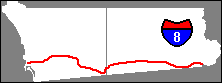
The part of I-8 west of I-5 is called the Ocean Beach Freeway. The part
east of I-5 and west of El Cajon is sometimes called the Alvarado Freeway or
the Mission Valley Freeway. The part east of El Cajon has been renamed the
Kumeyaay Freeway, and a sign reading "Kumeyaay Highway" appears at the west end
in Ocean Beach.
The bridge at Exit 19 in California (2nd St) is signed as the
"Danielle van Dam Memorial Overpass" in memory of Danielle van Dam,
who was murdered by a neighbor in San Diego in 2002.
Signs for Exit 19 contain blank spots where C-54 used to be.
I-8 runs parallel to old US Highway 80 and has entirely replaced it
as far east as Casa Grande, Arizona.
I-8 crosses the San Diego/Imperial County line more than once, because
that area is quite mountainous and the freeway has quite a few curves.
Call box distances in Imperial County are apparently measured from the
first crossing encountered by eastbound travellers, just a short distance
east of the In-Ko-Pah Park Road exit.
A temporary Border Patrol Inspection Station was in operation on westbound
I-8 between Exit 151 and Exit 146 on November 5, 2009.
I-8 Eastbound
- 000.0 - (freeway begins at Nimitz Blvd & Sunset Cliffs Blvd)
- 001.6 - (exit 2) I-5 SOUTH
- 002.6 - (exit 3) Taylor St, Hotel Circle
- 003.9 - (exit 4A) Hotel Circle
- 004.2 - (exit 4B) SOUTH C-163, Downtown (Downtown San Diego)
- 004.3 - (exit 4C) NORTH C-163, Escondido
- 004.5 - (exit 5) Mission Center Rd, Auto Circle
- 005.7 - (exit 6A) Texas Street, Qualcomm Way (formerly Stadium Way)
- 006.0 - (exit 6B) I-805
- 007.5 - (exit 7) SOUTH C-15
- 007.6 - (exit 7) Mission Gorge Rd, NORTH I-15, Fairmount Ave
- 009.0 - (exit 9) Waring Road
- 010.4 - (exit 10) College Ave (also San Diego State University)
- 011.6 - (exit 11) 70th Street, Lake Murray Bl (also Alvarado Rd)
- 012.6 - (exit 12) Fletcher Parkway
- 013.1 - (exit 13A) Spring St, Downtown (Downtown La Mesa)
- 013.9 - (exit 13B) Jackson Drive, Grossmont Blvd
- 014.1 - (exit 14A) C-125
- 014.3 - (exit 14B) La Mesa Blvd, Grossmont Center Dr
- 014.5 - (exit 14C) Severin Dr, Fuerte Dr
- 015.9 - (exit 15) El Cajon Blvd (also Chase Ave, Blvd Place)
- 016.9 - (exit 16) Main Street
- 017.6 - (exit 17A) Johnson Ave
- 017.9 - (exit 17B) C-67
- 018.1 - (exit 17C) Magnolia Ave, Civic Center
- 018.8 - (exit 18) Mollison Avenue
- 019.7 - (exit 19) 2nd St (also formerly C-54)
- 021.2 - (exit 20) Greenfield Dr.
- 022.5 - (exit 22) Los Coches Rd, Lakeside
- 024.3 - (exit 23) Lake Jennings Park Road
- 028.4 - (exit 27) Harbison Canyon, Dunbar Lane
- 031.2 - (exit 30) Alpine, Tavern Rd
- 034.3 - (exit 33) Alpine Blvd, Willows Rd
- 037.4 - (exit 36) East Willows Rd
- 038.7 - VISTA POINT
- 041.0 - (exit 40) C-79, Descanso, Japatul Vly Rd
- 046.9 - (exit 45) Pine Valley
- 048.3 - (exit 47) Sunrise Highway (also S1)
- 052.4 - (exit 51) Buckman Springs Rd (also S1, Buckman Springs Rest Stop, Lake Morena, Campo)
- 055.5 - (exit 54) Cameron Station, Kitchen Creek Rd
- 062.9 - (exit 61) Crestwood Rd, Live Oak Springs
- 067.7 - (exit 65) C-94, Campo, Boulevard
- 076.2 - (exit 73) Jacumba
- 079.0 - BRAKE CHECK AREA (also Border Patrol Inspection Station)
- 080.0 - (exit 77) In-Ko-Pah Park Rd
- 083.3 - (exit 80) Mountain Springs Rd
- 084.2 - RUNAWAY TRUCK RAMP
- 090.4 - (exit 87) C-98, Calexico
- 092.1 - (exit 89) Ocotillo, Imperial Hwy (also S2, Desert Parks, Plaster City)
- 104.0 - (exit 101) Dunaway Road
- 110.8 - (exit 107) Drew Rd, Seeley (also S29, Sunbeam Lake, NAF El Centro)
- 112.1 - (exit 108) REST AREA (Sunbeam Rest Area, closed to March 20, 2011)
- 115.0 - (exit 111) Forrester Rd (also Westmoreland)
- 118.3 - (exit 114) Imperial Ave, El Centro (also Imperial, Brawley)
- 119.2 - (exit 115) 4th St, El Centro, C-86 (also Heber)
- 120.2 - (exit 116) Dogwood Rd
- 122.1 - (exit 118A) C-111 SOUTH, Calexico (also Mexico)
- 122.5 - (exit 118B) C-111 NORTH, Brawley (also Indio, Imperial Valley College)
- 123.9 - (exit 120) Bowker Rd
- 129.3 - (exit 125) C-7 SOUTH, Orchard Rd (also S32, Holtville, border crossing)
- 132.2 - (exit 128) Bonds Corner Rd
- 135.3 - (exit 131) C-115 JUNCTION (also Van der Linden Rd)
- 148.0 - (exit 143) C-98 Junction
- 151.2 - (exit 146) Brock Research Center Road (closed for construction)
- 156.1 - (exit 151) Gordons Well
- 161.1 - (exit 155) REST AREA (exit left)
- 161.4 - (exit 156) Grays Well Road
- 164.5 - (exit 159) Ogilby Rd (also S34, Blythe)
- 169.6 - (exit 164) Sidewinder Road
- 171.8 - (exit 166) Algodones Rd, Andrade (also C-186, Araz Rd)
- 176.2 - (exit 170) Winterhaven Drive (also I-8 Business, Winterhaven, S24)
- 177.8 - (exit 172) Winterhaven, Fourth Avenue (also Yuma)
- 178.5 - (freeway leaves California)
I-8 Westbound
- 000.0 - (freeway enters California)
- 001.2 - (exit 172) Winterhaven, Fourth Ave
- 002.9 - (exit 170) Winterhaven Drive (also S24)
- 007.3 - (exit 166) Algodones Rd, Andrade (also C-186, Araz Rd)
- 008.9 - Inspection Station (also truck weigh station)
- 009.4 - (exit 164) Sidewinder Road
- 014.5 - (exit 159) Ogilby Rd (also S34, Blythe)
- 017.8 - (exit 156) Grays Well Road
- 018.5 - (exit 155) REST AREA (exit left)
- 023.0 - (exit 151) Gordon Wells (misspelling of Gordons Well)
- 027.8 - (exit 146) Brock Research Center Road (closed for construction)
- 031.0 - (exit 143) C-98, Calexico
- 043.7 - (exit 131) C-115, Van Der Linden Rd (also Holtville)
- 046.9 - (exit 128) Bonds Corner Road
- 049.7 - (exit 125) C-7 SOUTH, Orchard Rd (also S32, border crossing)
- 055.2 - (exit 120) Bowker Rd
- 056.7 - (exit 118B) NORTH C-111, Indio (also Brawley, Imperial Valley College)
- 057.0 - (exit 118A) C-111 SOUTH, Calexico
- 058.9 - (exit 116) Dogwood Rd
- 059.9 - (exit 115) 4th St, El Centro, C-86
- 060.9 - (exit 114) Imperial Ave, El Centro
- 064.0 - (exit 111) Forrester Rd (also S30, NAF El Centro)
- 066.9 - (exit 108) REST AREA (Sunbeam Rest Area closed to March 20, 2011)
- 068.2 - (exit 107) Drew Rd, Seeley (also S29, Sunbeam Lake)
- 074.9 - (exit 101) Dunaway Road (also Plaster City)
- 086.9 - (exit 89) Ocotillo, Imperial Hwy (also S2, Desert Parks, C-98)
- 096.2 - (exit 80) Mountain Springs Rd
- 099.2 - (exit 77) In-Ko-Pah Park Rd
- 103.2 - (exit 73) Jacumba
- 111.5 - (exit 65) C-94, Campo, Boulevard
- 116.5 - (exit 61) Crestwood Rd, Live Oak Springs
- 123.6 - (exit 54) Cameron Station, Kitchen Creek Rd
- 126.8 - (exit 51) Buckman Springs Rd (also S1, Buckman Springs Rest Stop, Lake Morena)
- 128.8 - (Border Patrol Inspection Station)
- 130.8 - (exit 47) Sunrise Highway (also S1)
- 132.4 - (exit 45) Pine Valley, Julian
- 138.2 - (exit 40) C-79, Descanso, Japatul Valley Rd
- 141.9 - (exit 36) East Willows Rd
- 145.0 - (exit 33) Alpine, Willows Rd
- 148.0 - (exit 30) Tavern Rd
- 150.8 - (exit 27) Harbison Canyon, Dunbar Lane
- 154.9 - (exit 23) Lake Jennings Park Road
- 156.8 - (exit 22) Los Coches Road
- 158.0 - (exit 20B) Greenfield Dr.
- 159.0 - (exit 20A) E Main St
- 159.5 - (exit 19) 2nd St (also formerly C-54)
- 160.5 - (exit 18) Mollison Avenue
- 161.0 - (exit 17) C-67, Magnolia Ave, Downtown (also Broadway, Fletcher Pkwy) (Downtown El Cajon)
- 162.4 - (exit 16) Main Street
- 164.4 - (exit 14C) Severin Dr, Fuerte Dr
- 164.6 - (exit 14B) TO C-94, SOUTH C-125 NORTH (SOUTH C-125 to C-94)
- 164.9 - (exit 14A) Grossmont Center Dr, La Mesa Blvd
- 165.5 - (exit 13B) Jackson Dr
- 165.9 - (exit 13A) El Cajon Blvd
- 166.6 - (exit 12) Fletcher Parkway, Baltimore Dr
- 167.7 - (exit 11) 70th Street, Lake Murray Blvd
- 168.8 - (exit 10) College Ave (also San Diego State University)
- 170.2 - (exit 9) Waring Rd
- 171.0 - (exit 8) Mission Gorge Rd, Fairmount Ave
- 171.4 - (exit 7B) I-15 NORTH, Riverside
- 171.5 - (exit 7A) C-15 SOUTH
- 172.8 - (exit 6B) Los Angeles, NORTH I-805
- 172.8 - (exit 6B) SOUTH I-805, National City, Chula Vista
- 173.1 - (exit 6A) Texas St, Qualcomm Way (formerly Stadium Way)
- 174.3 - (exit 5) Mission Center Rd, Auto Circle
- 174.8 - (exit 4B) Hotel Circle, C-163 NORTH
- 175.1 - (exit 4A) SOUTH C-163, Downtown
- 176.6 - (exit 3) Taylor St, Hotel Circle
- 177.1 - (exit 2C) Morena Blvd
- 177.3 - (exit 2B) C-209, SOUTH I-5, Rosecrans St
- 177.5 - (exit 2A) NORTH I-5, Los Angeles
- 178.6 - (exit 1) West Mission Bay Dr, Sports Arena Blvd
- 179.7 - Nimitz Blvd, Sunset Cliffs Blvd (freeway ends)
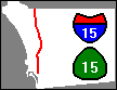
To prevent confusion, California and interstate highways are usually
given different numbers. However, C-15 and I-15 have been given the same
number for a good reason. The gap between the north end of C-15 and the
south end of I-15 has been filled by a new freeway segment,
which is now open and complete. For all practical purposes,
C-15 and I-15 are a single freeway.
The name C-15 applies to all parts of the freeway south of I-8.
The name I-15 applies to everything north of I-8. However, the sign
at the southern entrance to C-15 says I-15, not C-15.
This freeway actually has a number of names. Here they are, from
south to north:
- Archie Moore Memorial Freeway
- Escondido Freeway
- Avocado Highway
- Temecula Valley Freeway
I-15 has the only completely separate carpool lanes (also called
high-occupancy vehicle lanes or HOV lanes) in San Diego County,
although others are being constructed. The lanes run
along the I-15 median between the junctions with C-52 and C-56 and
are being extended into Escondido. The
carpool lanes are open to southbound traffic during the morning rush
hour, and to northbound traffic during the afternoon rush hour, but they
are closed at other times. Use is limited to buses, highway maintenance
vehicles, emergency vehicles, cars containing two or more live human
beings, and a few people who have bought special permits allowing them
to drive alone in the carpool lanes.
Motorists can enter or leave the carpool lanes ONLY at the north and
south ends; there are no entrances or exits at intermediate points. At
the south end, there are entrances from, and exits to, both I-15 and
C-163.
Motorists who want to drive solo in these carpool lanes must get a
"FasTrak" transponder that collects the toll electronically.
For information call 1-800-378-TRAK or visit
www.tcagencies.com.
A few years ago, these carpool lanes were the site of an unusual experiment
in which automobiles were driven entirely by automatic controls while human
observers were in them.
I-15 runs parallel to old US Highway 395 and has replaced it
in San Diego and Riverside Counties and some of San Bernardino County.
It has also replaced some of old US Highway 66 in San Bernardino County.
Continuing construction between exits 13 and 32 has required temporary
closure of some exits and the use of temporary signs that may not
match the wording on this list.
C-15 and I-15 Northbound
- 000.0 - (freeway begins at 32nd Street and Norman Scott Rd)
- 000.9 - (exit 1) Ocean View Boulevard
- 001.6 - (exit 2A) Market St
- 002.0 - (exit 2B) C-94 EAST M L King Jr Fwy, Home Ave
- 002.2 - (exit 2C) C-94 M L King Jr Fwy WEST
- 003.3 - (exit 3) Los Angeles, NORTH I-805
- 004.3 - (exit 5A) University Ave, City Heights, Transit Plaza
- 004.5 - (exit 5B) El Cajon Blvd (also Boulevard Transit Plaza)
- 005.3 - (exit 6A) Adams Ave
- 006.1 - (exit 6B) Junction I-8, Camino del Rio South
- 007.0 - (exit 7A) Friars Road East
- 007.1 - (exit 7B) Friars Rd West, Stadium
- 008.5 - (exit 8) Aero Drive
- 009.3 - (exit 9) Balboa Ave, C-274, Tierrasanta Blvd
- 010.2 - (exit 10) Clairemont Mesa Blvd
- 010.5 - (exit 11) Junction C-52
- 013.0 - (exit left) (Carpool Lanes, apparently closed for construction)
- 013.7 - (exit 13) Miramar Way (also MCAS Miramar)
- 014.6 - (exit 14) Pomerado Rd, Miramar Rd (also Alliant International University)
- 015.5 - (exit 15) Carroll Canyon Road
- 016.4 - (exit 16) Mira Mesa Blvd (also Lake Miramar)
- 017.9 - (exit 17) Mercy Rd, Scripps Poway Pkwy
- 018.8 - (exit 18) Poway Road, Rancho Pe�asquitos Blvd
- 019.8 - (exit 19) Jct C-56 WEST, Ted Williams Pkwy
- 021.3 - (exit 21) Carmel Mountain Rd
- 022.7 - (exit 22) Camino Del Norte
- 023.7 - (exit 23) Bernardo Center Dr
- 024.5 - (exit 24) Rancho Bernardo Rd
- 026.9 - (exit 26) West Bernardo Dr, Pomerado Rd (also Highland Valley Road, S5)
- 027.9 - (exit 27) Via Rancho Pkwy
- 028.5 - (exit 28) Centre City Pkwy
- 029.7 - (exit 29) Citracado Pkwy, Felicita Road
- 031.1 - (exit 30) 9th Avenue, Auto Park Way
- 031.8 - (exit 31) Valley Parkway, Downtown (also S6) (Downtown Escondido)
- 032.6 - (exit 32) C-78
- 034.1 - (exit 33) El Norte Parkway
- 037.9 - (exit 37) Deer Springs Rd, Mountain Meadow Rd (also S12)
- 042.3 - (exit 41) Gopher Canyon Rd, Old Castle Rd
- 044.8 - (exit 43) Old Highway 395 (also West Lilac Rd)
- 048.1 - (exit 46) Pala, Oceanside, C-76
- 052.5 - (exit 51) Mission Rd, Fallbrook (also S13)
- 056.1 - (exit 54) Rainbow Valley Blvd
- 057.4 - TRUCK SCALES
- 057.8 - (Border Patrol Checkpoint)
- 059.9 - (exit 58) C-79 SOUTH, Indio, Temecula Pkwy
- 061.6 - (exit 59) Rancho Calif Rd, Old Town, Front St
- 063.3 - (exit 61) C-79 NORTH, Winchester Road
- 065.3 - (exit 63) Riverside, San Bernardino, I-215
- 066.2 - (exit 64) Murrieta Hot Springs Rd
- 067.4 - (exit 65) Calif Oaks Road (also Kalmia St)
- 070.6 - (exit 68) Clinton Keith Road
- 072.0 - (exit 69) Baxter Road
- 073.3 - (exit 71) Bundy Canyon Road
- 076.2 - (exit 73) Diamond Drive, Railroad Cyn Rd
- 078.1 - (exit 75) Main St
- 079.5 - (exit 77) C-74, Central Ave
C-15 and I-15 Southbound
- 000.0 - (exit 77) C-74, Central Ave
- 001.5 - (exit 75) Main St
- 003.4 - (exit 73) Diamond Drive, Railroad Cyn Rd
- 006.3 - (exit 71) Bundy Canyon Road
- 007.6 - (exit 69) Baxter Road
- 009.1 - (exit 68) Clinton Keith Road
- 012.3 - (exit 65) Calif Oaks Road (also Kalmia Street)
- 013.3 - (exit 64) Murrieta Hot Springs Rd (also I-215 NORTH Riverside)
- 016.4 - (exit 61) Winchester Rd (also C-79 NORTH)
- 018.2 - (exit 59) Rancho Cal Rd, Old Town, Front St
- 019.7 - (exit 58) C-79 SOUTH, Temecula Pkwy
- 023.4 - (exit 54) Rainbow Valley Blvd (also TRUCK SCALES)
- 027.1 - (exit 51) Mission Rd, Fallbrook (also S13)
- 031.2 - (exit 46) Pala, Oceanside, C-76
- 034.5 - (exit 43) Old Highway 395
- 037.3 - (exit 41) Gopher Canyon Rd, Old Castle Rd (also Champagne Blvd, Lawrence Welk Dr)
- 041.6 - (exit 37) Deer Springs Rd, Mountain Meadow Rd (also S12)
- 044.4 - (exit 34) Centre City Parkway
- 045.5 - (exit 33) El Norte Parkway
- 046.8 - (exit 32) Oceanside, Ramona, C-78
- 047.8 - (exit 31) Valley Pkwy (also S6) (Downtown Escondido)
- 048.4 - (exit 30) 9th Avenue, Auto Park Way
- 049.6 - (exit 29) Citracado Pkwy, Felicita Road
- 051.8 - (exit 27) Via Rancho Pkwy
- 052.8 - (exit 26) West Bernardo Dr, Pomerado Rd (also Highland Valley Road, S5) (disrupted by construction)
- 055.0 - (exit 24) Rancho Bernardo Rd
- 055.9 - (exit 23) Bernardo Center Drive
- 056.9 - (exit 22) Camino del Norte
- 058.3 - (exit 21) Carmel Mountain Rd
- 059.5 - (exit 19) Ted Williams Pkwy, C-56 WEST
- 059.9 - (Carpool Lanes)
- 060.7 - (exit 18) Poway Road, Rancho Pe�asquitos Blvd
- 061.7 - (exit 17) Scripps Poway Pkwy, Mercy Road
- 063.1 - (exit 16) Mira Mesa Blvd (also Lake Miramar)
- 064.2 - (exit 15) Carroll Canyon Road
- 064.7 - (exit 14) Pomerado Rd, Miramar Rd (also Alliant International University)
- 065.7 - (exit 13) Miramar Way (also MCAS Miramar)
- 067.2 - (exit 12) SOUTH C-163
- 068.6 - (exit 11) Clairemont Mesa Blvd, C-52
- 070.1 - (exit 9) Balboa Ave, C-274, Tierrasanta Blvd
- 071.1 - (exit 8) Aero Drive
- 072.7 - (exit 7) Friars Road, Stadium
- 073.2 - (exit 6B) EAST I-8 El Centro, Beaches WEST I-8 (also Camino Del Rio S)
- 074.6 - (exit 6A) Adams Ave
- 075.1 - (exit 5B) El Cajon Blvd (also Boulevard Transit Plaza)
- 075.3 - (exit 5A) University Ave (also City Heights Transit Plaza)
- 076.3 - (exit 3) I-805 SOUTH, TO C-94 EAST
- 077.9 - (exit 2B) C-94 WEST, M L King Jr Fwy
- 078.4 - (exit 2A) Market St
- 079.0 - (exit 1D) Ocean View Boulevard
- 079.5 - (exit 1C) NORTH I-5
- 079.5 - (exit 1B) I-5 SOUTH, National City, Chula Vista (also Main St, National City Bl) (exit left)
- 079.6 - (exit 1A) Harbor Drive, Main Street
- 080.1 - (freeway ends at 32nd St and Norman Scott Rd)

Jacob Dekema is a former director of the California Department
of Transportation. I-805 was formerly called the Inland Freeway.
There are two "Palm Ave" exits from southbound I-805, an ambiguity
that was be removed when the exits were numbered.
I-805 Northbound
- 000.0 - (freeway begins at exit from northbound I-5)
- 000.2 - (exit 1A) San Ysidro Blvd
- 001.2 - (exit 1B) WEST C-905 EAST
- 002.5 - (exit 2) Palm Ave
- 003.4 - (exit 3) Main Street, Auto Park Dr (formerly Main Street, Otay Valley Rd)
- 004.1 - (exit 4) Olympic Pkwy, E Orange Ave (formerly Orange Avenue)
- 005.8 - (exit 6) L Street, Telegraph Canyon Rd
- 006.8 - (exit 7) E Street, Bonita Rd, H Street
- 008.4 - (exit 8) WEST C-54, EAST C-54
- 009.0 - (exit 9) Sweetwater Rd
- 010.3 - (exit 10) Plaza Blvd
- 011.2 - (exit 11A) 43rd Street
- 011.4 - (exit 11B) 47th Street
- 012.3 - (exit 12A) Imperial Ave
- 013.0 - (exit 12B) Market St
- 013.2 - (exit 13A) WEST C-94 EAST, M L King Jr Fwy
- 014.0 - (exit 13B) Home Ave
- 014.8 - (exit 14) Junction NORTH C-15
- 016.1 - (exit 15) University Avenue
- 016.7 - (exit 16) El Cajon Blvd
- 017.7 - (exit 17) WEST Beaches I-8 EAST El Centro
- 019.0 - (exit 18) Murray Ridge Rd, Phyllis Place
- 020.5 - (exit 20A) Mesa College Dr, Kearny Villa Rd
- 021.0 - (exit 20B) Escondido, NORTH C-163
- 021.9 - (exit 21) Balboa Ave, C-274
- 022.9 - (exit 22) Clairemont Mesa Boulevard
- 023.9 - (exit 23) Junction C-52
- 025.0 - (exit 24) Governor Drive
- 025.8 - (exit 25A) Nobel Drive
- 026.4 - (exit 25B) La Jolla Village Dr, Miramar Road
- 027.4 - (exit 27A) Mira Mesa Blvd, Vista Sorrento Pkwy
- 027.8 - (exit 27B) Sorrento Valley Rd
- 029.0 - LOCAL BYPASS, Jct C-56 EAST (also Carmel Mountain Rd)
- 030.3 - (freeway ends at I-5)
I-805 Southbound
- 000.0 - (freeway begins at exit from southbound I-5)
- 001.3 - (exit 27) Mira Mesa Blvd, Sorrento Valley Rd
- 002.6 - (exit 25B) Miramar Road, La Jolla Village Dr
- 004.2 - (exit 24) Governor Drive
- 004.9 - (exit 23) Junction C-52
- 006.1 - (exit 22) Clairemont Mesa Blvd
- 007.0 - (exit 21) Balboa Ave, C-274
- 008.2 - (exit 20) Downtown, SOUTH C-163 (Downtown San Diego)
- 010.0 - (exit 18) Murray Ridge Rd, Phyllis Place
- 011.1 - (exit 17B) Beaches, El Centro, I-8
- 012.2 - (exit 17A) Adams Ave, Madison Ave
- 012.6 - (exit 16) El Cajon Blvd
- 013.2 - (exit 15) North Park Way, University Ave
- 014.0 - (exit 14) SOUTH C-15, To WEST C-94, M L King Jr Fwy
- 015.1 - (exit 13B) Home Ave
- 015.3 - (exit 13A) C-94 EAST, M L King Jr Fwy
- 015.9 - (exit 12B) Market St
- 016.9 - (exit 12A) Imperial Ave
- 017.7 - (exit 11B) 43rd St
- 017.9 - (exit 11A) Palm Ave
- 018.9 - (exit 10) Plaza Blvd
- 020.2 - (exit 9) EAST C-54 WEST
- 020.4 - (exit 8) Sweetwater Rd
- 021.5 - (exit 7C) E St, Bonita Road
- 022.2 - (exit 7B) H Street West
- 022.4 - (exit 7A) H Street East
- 023.2 - (exit 6) Telegraph Canyon Rd EAST, L Street WEST
- 025.1 - (exit 4) E Orange Ave, Olympic Pkwy (formerly Orange Avenue)
- 025.8 - (exit 3) Main St, Auto Park Drive (formerly Otay Valley Rd, Main Street)
- 026.5 - (exit 2) Palm Ave
- 027.5 - (exit 1C) EAST C-905 WEST
- 028.9 - (exit 1B) San Ysidro Blvd
- 029.7 - (exit 1A) Camino de la Plaza, LAST USA EXIT
- 030.0 - (freeway ends at I-5)

The portion of C-163 south of Robinson Avenue runs through a wooded
canyon in the middle of Balboa Park, and has been designated a scenic
highway.
C-163 Northbound
- 000.0 - (freeway begins on 11th Ave at A Street)
- 000.1 - (exit 1A) NORTH I-5, Los Angeles
- 001.1 - (exit 1B) Quince St, Balboa Park
- 001.2 - (exit 1C) Zoo-Museums, Richmond St
- 001.9 - (exit 2A) Robinson Avenue
- 002.2 - (exit 2B) Washington St EAST
- 003.2 - (exit 3A) EAST I-8, El Centro
- 003.4 - (exit 3B) I-8 WEST
- 003.4 - (exit 3B) Friars Rd
- 005.2 - (exit 5A) Genesee Ave East
- 005.5 - (exit 5B) Genesee Ave West
- 006.0 - (exit 6) Mesa College Dr, Kearny Villa Rd
- 006.5 - (exit 7A) Los Angeles, NORTH 805
- 007.5 - (exit 7B) WEST C-274 EAST, Balboa Ave
- 008.2 - (exit 8) Clairemont Mesa Blvd (also Kearny Villa Road)
- 009.2 - (exit 9A) C-52 EAST
- 009.4 - (exit 9B) WEST C-52
- 010.3 - (exit 10) Kearny Villa Road
- 011.0 - (Carpool Lanes)
- 011.5 - (freeway ends at I-15)
C-163 Southbound
- 000.0 - (freeway begins at exit from southbound I-15)
- 000.8 - (exit 10) Kearny Villa Road
- 002.1 - (exit 9) C-52 WEST
- 002.7 - (exit 8) Clairemont Mesa Boulevard
- 003.6 - (exit 7B) Balboa Ave, C-274
- 004.6 - (exit 7A) I-805 SOUTH
- 005.9 - (exit 5) Genesee Ave
- 007.5 - (exit 4) Friars Rd
- 008.1 - (exit 3B) Hotel Circle
- 008.1 - (exit 3B) I-8 WEST
- 008.2 - (exit 3A) I-8 EAST, El Centro
- 008.9 - (exit 2C) 6th Ave, University Ave
- 009.1 - (exit 2B) Washington St WEST
- 009.2 - (exit 2A) Washington St EAST
- 010.7 - (exit 1B) I-5, Park Blvd, 4th Ave
- 011.5 - (exit 1A) Ash St
- 011.6 - (freeway ends on 10th Ave at A Street)

The junction of C-94 and C-125 may be slightly confusing. Before the
eastern part of the C-94 Freeway was built, the western part of C-94 and
C-125 were a single freeway, called the Helix Freeway. Eastbound motorists
must take an exit to stay on C-94.
The words "M L King Jr Fwy" have been added to some of the
signs for C-94.
The non-freeway portion of C-94 is described on the page
devoted to California Highway 94.
C-94 Eastbound
- 000.0 - (freeway begins on G Street at 17th Street)
- 000.9 - (exit 1) 28th Street
- 001.5 - (exit 2A) SOUTH C-15
- 001.7 - (exit 2B) Home Ave
- 001.8 - (exit 2C) NORTH C-15, TO I-805 NORTH (exit left)
- 002.5 - (exit 3) SOUTH I-805
- 003.6 - (exit 4A) Euclid Ave
- 004.4 - (exit 4B) Kelton Road
- 004.8 - (exit 5) Federal Blvd
- 006.6 - (exit 6) Broadway, College Ave
- 007.1 - (exit 7) Massachusetts Avenue
- 007.7 - (exit 8) Lemon Grove Avenue
- 008.4 - C-125 SOUTH
- 008.5 - (exit 9A) C-94 EAST, La Mesa, Spring St (C-125 straight ahead, C-94 to right)
- 009.1 - (exit 9B) La Mesa, Spring St
- 009.7 - (exit 10A) Bancroft Drive
- 010.4 - (exit 10B) Kenwood Dr, Casa de Oro
- 011.5 - (exit 11) Sweetwater Springs Boulevard
- 012.0 - (exit 12) Avocado Blvd, Calavo Dr
- 012.7 - (freeway ends on Campo Rd at Via Mercado)
C-94 Westbound
- 000.0 - (freeway begins on Campo Rd at Via Mercado)
- 000.2 - (exit 12) Calavo Dr, Avocado Blvd
- 000.7 - (exit 11) Sweetwater Springs Blvd, Casa de Oro
- 001.7 - (exit 10B) Kenwood Dr
- 002.5 - (exit 10A) Bancroft Dr (formerly also C-125 NORTH)
- 003.0 - (exit 9C) Spring St
- 003.0 - (exit 9B) NORTH C-125
- 003.5 - (exit 9A) C-125 SOUTH (exit left)
- 004.7 - (exit 8) Lemon Grove Avenue
- 005.4 - (exit 7) Massachusetts Avenue
- 005.9 - (exit 6B) College Ave
- 006.5 - (exit 6A) College Grove Way
- 008.0 - (exit 5) Federal Blvd, Kelton Road
- 008.5 - (exit 4) Euclid Ave
- 009.5 - (exit 3) SOUTH I-805 NORTH (also Home Ave)
- 010.8 - (exit 2) SOUTH C-15 (exit left)
- 011.2 - (exit 1D) 30th Street
- 011.6 - (exit 1C) 28th Street
- 012.0 - (exit 1B) 25th Street
- 012.3 - (exit 1A) NORTH I-5 Los Angeles
- 012.7 - (freeway ends on F Street at 17th Street)

The interchange between C-125 and C-94 is rather complex, being the
result of several major changes in both highways. Many years ago,
the part of C-125 south of this interchange did not exist, and the
part of C-94 east of it was not a freeway. At that time, C-125
and the western part of C-94 appeared to be a single freeway.
The part of C-125 south of C-54 is a toll road, the only
one in San Diego County. It is also called the South Bay Expressway.
For more information, see
www.southbayexpressway.com.
Bicycles are allowed on the shoulders of C-125
south of the Birch Rd. exit. There is no toll for bicycles.
Note: Jamacha is pronounced HAM-uh-shaw.
C-125 Northbound
- 000.0 - (freeway begins on Otay Mesa Rd)
- 000.9 - (toll plaza)
- 003.8 - (exit 5) Birch Rd
- 004.6 - (exit 6) Olympic Pkwy
- 005.6 - (exit 7) Otay Lakes Rd
- 006.6 - (exit 8) East H St
- 010.4 - C-54 WEST (exit left) (C-54 EAST, C-125 NORTH to right)
- 011.4 - (exit 12) Jamacha Blvd, Paradise Valley Rd
- 012.1 - (exit 13) Jamacha Road
- 014.2 - (exit 15) C-94 WEST, C-94 EAST (also La Mesa, Spring St)
- 016.2 - (exit 17A) Lemon Ave
- 016.5 - (exit 17B) Grossmont Bl
- 016.7 - (exit 18A) EAST I-8
- 017.1 - (exit 18A) WEST I-8
- 017.6 - (exit 18B) Fletcher Pkwy (also Amaya Dr)
- 018.5 - (exit 20A) Navajo Road
- 018.8 - (exit 20B) Grossmont College Dr (also Grossmont College)
- 020.8 - (exit 22) WEST C-52
- 021.3 - (freeway ends on Mission Gorge Rd)
C-125 Southbound
- 000.0 - (freeway begins at Mission Gorge Road)
- 001.4 - (exit 20B) Grossmont College Dr
- 002.2 - (exit 20A) Navajo Rd
- 003.3 - (exit 18B) Fletcher Pkwy
- 003.9 - (exit 18A) EAST I-8 WEST
- 004.2 - (exit 17B) Grossmont Bl
- 005.9 - (exit 17A) C-94 EAST, Spring St
- 006.4 - (exit 15) C-94 WEST (C-125 SOUTH right, C-94 WEST straight ahead)
- 008.8 - (exit 13) Jamacha Road
- 009.7 - (exit 12) Jamacha Blvd, Paradise Valley Rd
- 010.4 - C-54 WEST (exit left) (C-125 SOUTH Chula Vista to right)
- 013.2 - San Miguel Ranch Rd, Mount Miguel Rd
- 014.3 - (exit 8) East H St
- 015.3 - (exit 7) Otay Lakes Rd
- 016.3 - (exit 6) Olympic Pkwy
- 017.1 - (exit 5) Birch Rd
- 020.6 - (toll plaza)
- 021.5 - (freeway ends on Otay Mesa Rd)
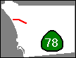
The non-freeway portion of C-78 is described on the page
devoted to California Highway 78.
C-78 Eastbound
- 000.0 - I-5 SOUTH, San Diego (freeway begins on Vista Way at I-5)
- 000.1 - I-5 NORTH, Los Angeles
- 000.6 - (exit 1) Jefferson St
- 001.3 - (exit 2) El Camino Real (also S11)
- 003.1 - (exit 3) College Blvd (MiraCosta College)
- 003.5 - (exit 4A) Plaza Dr
- 004.2 - (exit 4B) Emerald Dr
- 005.7 - (exit 6A) Melrose Dr (also S13) (Vista Court Complex)
- 006.0 - (exit 6B) Vista Village Dr
- 006.7 - (exit 7) Civic Center Dr (formerly Escondido Ave)
- 007.6 - (exit 8) Mar Vista Dr
- 008.9 - (exit 9) Sycamore Ave
- 010.4 - (exit 11A) Rancho Santa Fe Rd (also S10) (Palomar College, Lake San Marcos)
- 011.0 - (exit 11B) Las Posas Rd
- 011.9 - (exit 12) San Marcos Blvd (also S12)
- 012.7 - (exit 13) Twin Oaks Valley Rd
- 013.7 - (exit 14) Barham Dr, Woodland Pkwy
- 015.2 - (exit 15) Nordahl Rd
- 016.1 - (exit 17A) I-15 SOUTH, San Diego
- 016.3 - (exit 17B) I-15 NORTH, Riverside
- 017.0 - (exit 17C) Centre City Pkwy
- 017.6 - (freeway ends on Lincoln Pkwy at Broadway)
C-78 Westbound
- 000.0 - (freeway begins on Lincoln Pkwy at Broadway)
- 000.8 - (exit 17) San Diego, Riverside, I-15
- 002.0 - (exit 15) Nordahl Rd
- 003.4 - (exit 14) Woodland Pkwy, Barham Dr
- 004.6 - (exit 13) Twin Oaks Valley Rd (Palomar College, Cal State University San Marcos)
- 005.3 - (exit 12) San Marcos Blvd (also S12)
- 006.6 - (exit 11B) Las Posas Rd
- 006.8 - (exit 11A) Rancho Santa Fe Rd (also S10)
- 008.3 - (exit 9) Sycamore Ave
- 009.6 - (exit 8) Mar Vista Dr
- 010.5 - (exit 7) Civic Center Dr (formerly Escondido Ave)
- 011.2 - (exit 6) Vista Village Dr (Vista Court Complex)
- 013.0 - (exit 4) Emerald Dr
- 014.0 - (exit 3) College Blvd (MiraCosta College)
- 015.9 - (exit 2) El Camino Real (also S11)
- 016.6 - (exit 1C) Jefferson St
- 017.3 - (exit 1B) I-5 NORTH, Los Angeles
- 017.6 - (exit 1A) I-5 SOUTH, San Diego (exit left) (freeway ends on Vista Way at I-5)

This freeway is sometimes called the Soledad Freeway.
Although bicycles are permitted on freeway shoulders in a number of
places in San Diego County, the part of C-52 between Santo Rd and Mast
Blvd is the only freeway that actually has bike lanes. At the time
of this writing (March 19, 2011), bicycles going in both directions
are required to share
a single lane on the north side, which is separated from the rest
of the freeway by K-rail barriers. This arrangement appears to be
permanent.
The part of La Jolla Parkway (formerly Ardath Road) between Ardath
Lane and the interchange with I-5 might reasonably be considered a
westward extension of this freeway. It has a fenced right of way, and
the junction with La Jolla Scenic Drive looks like an unfinished freeway
interchange. Therefore, it is included on this list as part of C-52.
C-52 Eastbound
- 000.6 - (freeway begins on La Jolla Parkway at Ardath Lane)
- 001.2 - I-5 SOUTH, Downtown (Downtown San Diego)
- 002.2 - (exit 1) Clairemont Mesa Blvd, Regents Road
- 003.5 - (exit 2) Genesee Avenue
- 004.5 - (exit 3) Junction I-805
- 006.5 - (exit 5) Convoy St
- 007.6 - (exit 6) C-163 SOUTH
- 007.8 - (exit 7) Kearny Villa Rd, Junction I-15
- 009.8 - (exit 8) Santo Rd
- 014.3 - (exit 13) Mast Blvd
- 015.8 - (exit 14) Mission Gorge Rd
- 016.1 - (exit 15) C-125 SOUTH
- 017.2 - (exit 17) Cuyamaca St
- 018.4 - (exit 18A) Magnolia Ave
- 018.5 - (exit 18B) C-67 SOUTH
- 018.5 - (exit 18C) C-67 NORTH (freeway ends)
C-52 Westbound
- 000.0 - (freeway begins at C-67)
- 001.7 - (exit 17) Cuyamaca St
- 002.2 - (exit 15B) Fanita Dr
- 002.6 - (exit 15A) C-125 SOUTH
- 004.1 - (exit 13) Mast Blvd
- 009.0 - (exit 8) Santo Rd
- 010.0 - (exit 7) I-15 SOUTH, Kearny Villa Rd, NORTH I-15
- 010.8 - (exit 6) SOUTH C-163
- 012.1 - (exit 5) Convoy St
- 013.8 - (exit 3) Junction I-805
- 015.4 - (exit 2) Genesee Ave
- 016.5 - (exit 1B) Clairemont Mesa Blvd, Regents Road
- 017.5 - (exit 1A) I-5 FREEWAY
- 018.0 - (freeway becomes La Jolla Parkway)
- 018.4 - La Jolla Scenic N. Dr. (very small exit sign)
- 019.0 - (freeway ends on La Jolla Parkway at Ardath Lane)

There are carpool lanes on C-54 from just east of I-805 to Briarwood Rd.
The westbound carpool lane is reserved for carpools during the morning rush
hour, and the eastbound carpool lane is reserved for carpools during the
afternoon rush hour.
The former intersection with Worthington Street and Sweetwater Road has
been obliterated by the interchange with C-125.
This freeway is also signed as the "Filipino-American Highway".
C-54 used to run farther east and north to join
I-8 in El Cajon. However, this part is now poorly marked and hard to
follow. Here are some useful directions:
- Eastbound:
- Continue
onto norhtbound C-125 and take the Jamacha Blvd, Paradise Valley Rd exit.
Turn right on Jamacha Blvd. and follow it to its end. Turn right
on C-94, which is also called Campo Rd. Where C-94 and Campo Road
turn right, continue straight ahead on Jamacha Rd. Follow Jamacha Rd.
east and north to the interchange with I-8. (Jamacha Rd. becomes
Second St. when it crosses Main St.)
- Westbound:
- Take the 2nd St exit from I-8. (The exit signs contain blank spaces
which once contained C-54.)
Go south on 2nd St., which becomes Jamacha Rd. when it crosses Main St.
Follow Jamacha Rd. until it is joined by C-94. Continue
straight ahead and turn left onto Jamacha Blvd., which is also signed
as San Diego County Highway S17. Follow Jamacha Blvd. to the interchange
with C-125. Enter C-125 SOUTH. The first exit is C-54 WEST.
This part of C-54 is now signed as such only on Jamacha Rd. between the
junction with Campo Rd. and the El Cajon city limit. In the city of El
Cajon, it is signed only as C-54 Business. West of the intersection of
Jamacha Rd. and Campo Rd. it is signed in some places as County Highway S17.
Note: Jamacha is pronounced HAM-uh-shaw.
C-54 Eastbound
- 000.0 - (freeway begins on I-5)
- 001.0 - (exit 1) Highland Ave, 4th Ave
- 001.7 - (exit 2) NORTH I-805 SOUTH
- 003.1 - (exit 3) Plaza Bonita Center Way, Reo Drive
- 004.3 - (exit 4) Woodman St
- 005.1 - (exit 5) Briarwood Rd
- 006.0 - (exit 6) C-125 SOUTH, Chula Vista
- 006.7 - (freeway ends on northbound C-125)
C-54 Westbound
- 000.0 - (freeway begins on southbound C-125)
- 001.4 - (exit 5) Briarwood Rd
- 002.1 - (exit 4) Woodman St
- 003.3 - (exit 3) Plaza Bonita Center Way, Reo Drive
- 004.3 - (exit 2) SOUTH I-805 NORTH
- 005.4 - (exit 1D) Highland Ave, 4th Ave
- 006.1 - (exit 1C) National City Blvd, Broadway
- 006.3 - (exit 1B) NORTH I-5 (exit 1A, I-5 SOUTH straight ahead)
- 006.9 - E Street
- 007.2 - (freeway ends on southbound I-5)
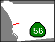
On July 19, 2004, the last segment of C-56 was opened. This freeway
now connects I-5 and I-15.
Camino Del Sur was formerly called Camino Ruiz. The old signs
have been removed, but the old name appeared in some editions of the
Thomas Guide before 2005.
Carmel Valley Road, which was once a continuous east-west road, has
been severed and realigned by the construction of C-56. The western part
begins on old Highway 101 (N. Torrey Pines Rd. and Camino Del Mar)
and runs west under I-5, coming to an end on El Camino Real a short distance
east of I-5. This part is mentioned on some freeway signs
on I-5 and C-56 in this area.
The rest of Carmel Valley Road begins at the Carmel Valley Road exit
from C-56, runs east and slightly north to meet Black Mountain Road,
and continues northeast to meet Dove Canyon Road and Bernardo Center
Drive.
C-56 formerly fed directly into a different alignment of Carmel Valley
Road which has been renamed Old Carmel Valley Road. The direct connection
with C-56 has been closed, but the road remains open because it provides
access to some residential areas north of C-56.
An old street sign at the intersection of Carmel Valley Road and
Rancho Santa Fe Farms Road erroneously identified Carmel Valley Road
as Black Mountain Road on July 17, 2004. Old timers may remember when
that section was called Black Mountain Road, but it is now an anachronism
that should be corrected soon.
There is no direct connection from southbound I-5 to eastbound C-56,
or from westbound C-56 to northbound I-5. Drivers making these connections
are directed onto surface streets.
For historical information about this particular freeway, see
Grant Cooper's Highway 56 Information Page.
This freeway was named after the late Ted Williams, a famous baseball
player who was born and raised in San Diego.
C-56 Eastbound
- 000.0 - (freeway begins on northbound I-5)
- 000.6 - (exit 1A) Carmel Creek Road
- 001.8 - (exit 1B) Carmel Country Road
- 002.7 - (exit 3) Carmel Valley Rd
- 005.8 - (exit 6) Camino Del Sur (formerly Camino Ruiz)
- 007.2 - (exit 7) Black Mountain Rd
- 008.3 - (exit 8) Rancho Peñasquitos Blvd
- 009.5 - (exit 9) (freeway ends at I-15)
C-56 Westbound
- 000.0 - (freeway begins at I-15)
- 001.0 - (exit 8) Rancho Peñasquitos Blvd
- 001.8 - (exit 7) Black Mountain Rd
- 003.2 - (exit 6) Camino Del Sur (formerly Camino Ruiz)
- 006.1 - (exit 3) Carmel Valley Rd
- 007.5 - (exit 1D) Carmel Country Road
- 008.4 - (exit 1C) Carmel Creek Road
- 009.0 - (exit 1B) El Camino Real, TO I-5 NORTH (also Carmel Valley Road) (straight ahead is exit 1A for I-5 SOUTH)
- 010.1 - (freeway ends on southbound I-5)

This freeway is signed as the "CHP Officer Christopher D. Lydon
Memorial Freeway".
The non-freeway portion of C-67 is described on the page
devoted to California Highway 67.
C-67 Northbound
- 000.0 - (freeway begins on Magnolia Ave at Madison Ave)
- 000.1 - (exit 1A) I-8 EAST, El Centro
- 000.2 - (exit 1B) I-8, San Diego (I-8 WEST)
- 000.5 - (exit 1C) Broadway, Fletcher Pkwy
- 001.2 - (exit 1D) Bradley Ave
- 002.0 - (exit 2) Prospect Ave, C-52 WEST (also Santee)
- 004.0 - (exit 4) Riverford Rd
- 005.0 - (exit 5) Winter Gardens Boulevard (Lakeside)
- 005.9 - Mapleview St (freeway ends on Highway 67 at Mapleview St)
C-67 Southbound
- 000.0 - (freeway begins on Highway 67 at Mapleview St)
- 001.3 - (exit 4) Riverford Rd
- 002.7 - (exit 3) Woodside Ave (Santee)
- 003.2 - (exit 2) C-52 WEST
- 004.3 - (exit 1D) Bradley Ave
- 005.0 - (exit 1C) Broadway, Fletcher Pkwy
- 005.3 - (exit 1A) WEST I-8, San Diego (exit left)
- 005.6 - (exit 1B) El Centro, I-8 (EAST I-8)
- 005.7 - (freeway ends on Magnolia Ave at Madison Ave)

This highway runs mostly east and west, although it has an odd number.
The eastern portion does turn south.
In July 2012, the freeway was completed. However, some construction
was still in progress during the latest survey,
so some mileages may not be accurate.
C-905 Eastbound
- 000.0 - (freeway begins on Tocayo Ave at Oro Vista Rd)
- 000.2 - I-5 SOUTH
- 000.5 - NORTH I-5
- 000.8 - (exit 1) Beyer Blvd
- 001.4 - (exit 2A) Picador Blvd, Smythe Ave
- 002.1 - (exit 2B) I-805
- 003.8 - (exit 4) Caliente Ave
- 005.8 - (exit 6) Britannia Blvd
- 006.8 - (exit 7) La Media Road (also C-125 NORTH)
- 008.4 - (exit 9) Siempre Viva Road (LAST USA EXIT)
- 009.0 - (exit left) (U-turn to USA)
- 009.1 - (freeway ends at US-Mexico border)
C-905 Westbound
- 000.0 - (freeway begins at US-Mexico border)
- 000.1 - (exit 9) Siempre Viva Rd
- 001.5 - (exit 7) La Media Road (also C-125 NORTH)
- 002.6 - (exit 6) Britannia Blvd
- 004.6 - (exit 4) Caliente Ave
- 006.0 - (exit 2C) I-805 NORTH
- 006.3 - (exit 2B) I-805 SOUTH
- 007.1 - (exit 2A) Picador Blvd, Smythe Ave
- 007.7 - (exit 1) Beyer Blvd
- 008.2 - NORTH I-5 (exit left)
- 008.7 - I-5 SOUTH
- 009.0 - (freeway ends on Tocayo Ave at Oro Vista Rd)
The 2.6-mile portion of Kearny Villa Road between the junction with C-163
and the intersection of Miramar Road might reasonably be described as
a freeway, although it is open to bicyclists and pedestrians.
The right of way is fenced, there is a substantial barrier in the median,
and there are full interchanges at
Harris Plant Rd and Miramar Way. In fact, before the parallel portion
of I-15 was built, it was a freeway.
Kearny Villa Road Northbound
- 0.00 - (freeway begins at interchange with C-163)
- 0.16 - Harris Plant Road
- 1.49 - MCAS Miramar (Miramar Way)
- 2.32 - FAA TRACON
- 2.49 - Kearny Mesa Road
- 2.69 - (freeway ends at Miramar Road)
Kearny Villa Road Southbound
- 0.00 - (freeway begins at Miramar Road)
- 0.76 - MCAS Miramar (Miramar Way) (sign is on exit ramp, not ahead of it)
- 2.10 - Harris Plant Road
- 2.60 - (freeway ends at interchange with C-163)
This material was first compiled during the first seven months of
1995, with many subsequent additions and changes.
While care has been taken to ensure accurate information, in a list of
this size some errors and omissions are likely. A number of freeways are
under construction at any given time, and changes in exit signs may be
expected. Therefore, complete accuracy cannot be guaranteed.
The raw data from which this list was compiled is available in
dBase III format.
-- Philip J. Erdelsky,
pje@efgh.com
Return to home page.