
Highway Map of San Diego and Imperial Counties
February 19, 2013
Philip J. Erdelsky, pje@efgh.com
|
|
Highway Map of San Diego and Imperial CountiesFebruary 19, 2013 Philip J. Erdelsky, pje@efgh.com |
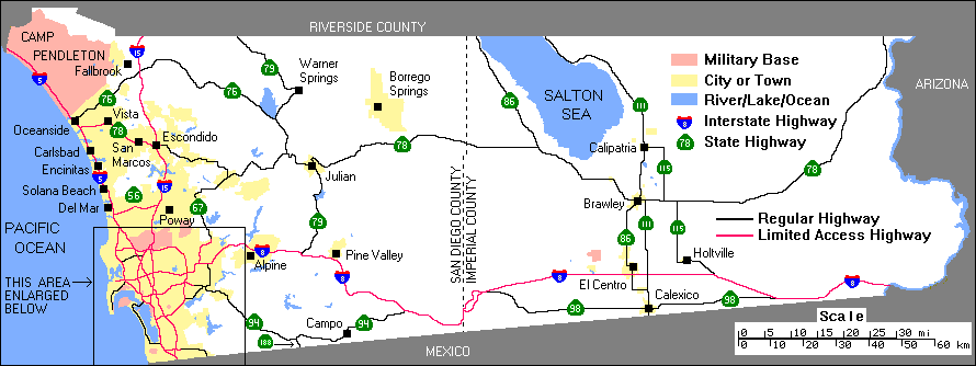
A map of San Diego and Imperial Counties in Southern California, showing all state and interstate highways. It is based on images generated by the U.S. Census Bureau's Tiger Mapping Service. For more information see tiger.census.gov.
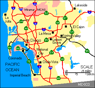 |
State highways 274 and 209 in San Diego, and state highway 54 in El Cajon and Spring Valley, have been decommissioned, although they are still signed in a few places. The part of state highway 125 between state highways 54 and 125 is a toll road. |