 Map of Holtville, California
Map of Holtville, California
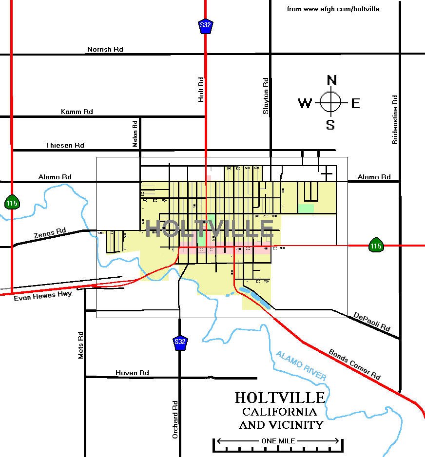
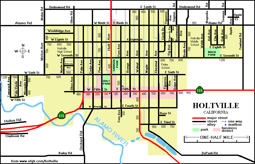
Map of Holtville, CaliforniaI "discovered" the town of Holtville, California while surveying a bike route along old Highway 80. Although Interstate 8 has diverted most of the through traffic well to the south of Holtville, the town remains a vibrant and charming place. See their official Web site at
www.holtville.ca.gov
One thing that the Holtville Web site lacks is a good city map. There is a link to MapQuest, but there is no public domain map. Even the Thomas Guide lacks a detailed map of Holtville.
I've decided to remedy that situation by posting two of my own maps. Holtville residents, and others, are welcome to download them, print them out, and use them for any lawful purpose.
The house numbering system in Holtville is fairly simple, probably because the terrain is fairly flat and nearly all the streets run north-south or east-west.
Unfortunately, the unincorporated areas around Holtville use a different numbering system, and in some cases different street names. The numbers along one side of a street at the edge of town may be much different from the numbers along the other side. In some cases, even the name changes:
| inside Holtville | outside Holtville |
|---|---|
| W. Sixth St. | Zenos Rd. |
| E. Ninth St. | Alamo Rd. |
| W. Ninth St. | Alamo Rd. |
| E. Tenth St. | Underwood Rd. |
| Cedar Ave. | Orchard Rd. |
| Holt Ave. | Holt Rd. |
| Maple Ave. | Di Paoli Rd. |
| Melon Ave. | Melon Rd. |
| Walnut Ave. | Bonds Corner Rd. |
Notice that, with very few exceptions, Holtville contains only streets and avenues and the surrounding area contains only roads.
Philip J. Erdelsky
February 11, 2008
Please E-mail comments and corrections to pje@efgh.com.